Gulf of Mexico Tidal Wetlands
A Photo Gallery of Florida's Big Bend Tidal Wetlands
|
|
||||||||||||||||||||||||||||||||||||||||||||
|
||||||||||||||||||||||||||||||||||||||||||||
|
|
Marsh Environments: Mangroves
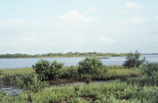
 healthy mangroves on the Big Bend coast
Mangroves dominate coastal wetlands in tropical latitudes. These trees are specially adapted to continual flooding and salt water. They grow along the Gulf coast of Florida as far north as Cedar Key. Mangroves are sensitive to cold temperatures and tend to be smaller in the northern part of their range.
Between Tampa Bay and Cedar Key (see map) mangroves are periodically killed by prolonged freezing winter temperatures. Mangroves are often replaced temporarily by smooth cordgrass until the trees recover. Standing dead mangrove trunks, or snags (see below), identify their location in the low marsh.
It can take 5-10 years for mangroves to reestablish their presence following severe freezes in this area.
dead mangroves |
recovering mangroves |
