
- Home
- About S&T
- Taxa/Organisms
- Ecosystems
- Issues
- Methods & Tools
- Reports & Publications
- Location
- Search
Publisher: USGS | Science Center: Fort Collins Science Center (FORT, Ft. Collins) | Format: URL
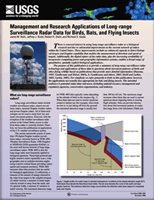
www.fort.usgs.gov — This publication is intended to provide a summary of long-range surveillance radar technology and applications of these data to questions about movement patterns of birds and other flying wildlife based on publications that provide more detailed information (Buurma, 1995; Gauthreaux and Belser, 2003a, b; Gauthreaux and others, 2003; Diehl and More...
Publisher: USGS | Science Center: Upper Midwest Environmental Sciences Center (UMESC, LaCrosse) | Format: URL
www.umesc.usgs.gov — This web resource is a tool for mapping and modeling migratory birds for bird conservation planning. The focus of this study is to develop statistically sound, science-based models to support public land management for high priority bird species within a regional context. The site links to a Project Description, Modeling Avian Abundance, Desktop More...

Publisher: NBII | Format: URL
www.nbii.gov — Natural resource managers face complex decisions that require a clear understanding of the status of wildlife populations and their habitats. Monitoring is key to making effective management decisions and evaluating the outcomes of those decisions. The goal of NRMP is to improve the accessibility of monitoring efforts to resource managers to aid More...

Publisher: USGS | Science Center: Fort Collins Science Center (FORT, Ft. Collins) | Format: URL
www.fort.usgs.gov — Natural Resource Monitoring Partnership (NRMP) is a collaborative effort by the natural resource management community to improve monitoring efforts in order to support effective evaluation and decision-making by sharing information on monitoring projects and protocols. The Natural Resource Monitoring Partnership was built for easy access to More...
