 |
 |
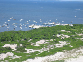
| The Sailors Haven Marina is adjacent to the Sunken Forest, a 250- to 300-year-old maritime forest comprised of American holly, sassafras, shadbush, black gum and oak trees. Protected behind a tall primary dune and a secondary dune system, the forest has been able to survive for centuries on a fragile, dynamic barrier island. |
 |
Fire Island's nationally significant natural resources created a foundation for the establishment of Fire Island National Seashore.
Fire Island is a barrier island that stretches east to west off the southern coast of Long Island, New York. Approximately 32 miles (55 km) long and averaging less than a mile (about 0.5 km) in width, the island is bordered by Fire Island Inlet to the west and Moriches Inlet to the east, and is separated from Long Island by the Great South Bay, Patchogue Bay, Bellport Bay, Narrow Bay and Moriches Bay. To its south is the vast Atlantic Ocean.
Under Public Law 88-587, (FIIS) was established on September 11, 1964, "for the purpose of conserving and preserving for the use of future generations relatively unspoiled and undeveloped beaches, dunes and other natural features…."
|
 |
| Almost 75 miles of coastline are within the boundaries of Fire Island National Seashore. |
 |
Fire Island National Seashore consists of 26 miles (42 km) of Fire Island itself (See Park Map). The Seashore encompasses 19,579 acres (7,832 hectares) of marine and terrestrial property within its boundaries, including Smith Point County Park located at the eastern end within the boundaries of the National Seashore, and the pre-existing communities on Fire Island. (See .)
Approximately 15,000 acres of the Park are submerged in the Great South Bay or Atlantic Ocean.
The boundary of Fire Island National Seashore extends approximately 4,000 feet into the bay, and approximately 1,000 feet seaward of the ocean shoreline. The park includes several islands, sand flats and wetlands landward of the of the barrier island.
|

|
| Barrier Island Cross Section |
|
|
The character, or physiognomy, of Fire Island is typical of Atlantic barrier islands that grade from a primary dune along the ocean to salt marsh along the bay. The dominant includes pitch pine (Pinus rigida), beach grass (Ammophilia breviligulata), wax myrtle (Myrica cerifera), bayberry (M. pensylvanica), shadbush (Amelanchier canadensis), and common greenbrier (Smilax rotundifolia). This particular composition of vegetation is typical of the island except within the various communities where residents have planted non-indigenous vegetation.
|
 |
| Vegetated swale behind a high primary dune at Sailors Haven. |
 |
The percentages of terrestrial habitats found at Fire Island National Seashore include: 10% forested and 40% wetlands, 25% open (beach, swale and fields), 25% developed either by the National Park Service or the 17 local communities on the island. Of the submerged portion, 80% is in the Great South Bay and 20% is the Atlantic Ocean. All existing habitats within the Seashore are listed as threatened.
|
 |
| Some of the American holly trees in the Sunken Forest are estimated to be 250-300 years old. |
 |
Unique resources include the Sunken Forest, a federal wilderness area (520 hectares), and eel grass beds. The Sunken Forest on Fire Island is a 16 hectare maritime oak-holly forest occurring behind the secondary dune, one of only a few mature maritime forests in the New York area and the northernmost holly-dominated maritime forest on the Atlantic barrier island chain. The Nature Conservancy listed this community type as (G2), and in 2001 the ranked this maritime holly forest as "globally rare" or "G1G2 S1" meaning there are few remaining occurrences of this assemblage of plants throughout the world. Both federal and New York State endangered species either breed or germinate in the park, along with eleven other species of concern.
|
The William Floyd Estate, located across Great South Bay on the Long Island mainland, is quite different from the Seashore's barrier island habitat. The William Floyd Estate is 65% forested, 25% wetlands including salt marsh, 5% open space and 5% developed around the estate house area. Species found at the Estate include great blue herons, great and snowy egrets, willets, and diamond-backed terrapins.
|
|
Learn More
The National Park Service is mandated to preserve and protect the natural resources, processes, systems, and values of the units of the National Park System in an unimpaired condition to perpetuate their inherent integrity and to provide present and future generations with the opportunity to enjoy them. Fire Island National Seashore's natural resources are managed according to the criteria found in the , .
|
|
In order to preserve and protect natural resources in parks for future generations, NPS managers must be able to evaluate current management and restoration practices, recognize changes and trends in the condition of the resources, and anticipate future threats to those resources.
The National Park Service has implemented a natural resource inventory and monitoring program for the parks. Fire Island National Seashore is grouped in the with seven other NPS areas that have similar natural resources. Each unit contains critical coastal habitat and protects vital coastal wetlands which are essential to water quality, fisheries, and the biological diversity.
NPS Northeast Coastal and Barrier Network
|
|
A series of was published in 2005 to support the preparation of a General Management Plan for Fire Island National Seashore.
-
-
-
-
(Fire Island National Seashore Science Synthesis Paper, Report coming soon) by David O. Conover, Robert Cerrato, and William Wise, Stony Brook University
-
-
|
 |
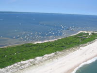
| About 3½ miles east of Sailors Haven and 1½ miles east of Fire Island Pines, the Talisman/Barrett Beach area is the narrowest part of Fire Island. |
 |
Additional Natural Resources Reports and Technical Reports are also produced by the National Park Service.
-
Technical Report NPS/NER/NRTR—2007/075
by S. J. Williams and M. K. Foley
National Park Service
-
Technical Report: NPS/NER/NRTR-2007/089 by C. T. Roman, J.W. King, D. R. Cahoon, J.C. Lynch, and P.G. Appleby
July 2007
Other recent publications provide valuable background information to help you better understand the resources and natural processes of Fire Island National Seashore.
Additional comprehensive research and studies have been conducted by the U. S. Army Corps of Engineers to identify, evaluate and recommend long-term solutions for hurricane and storm damage reduction for homes and businesses within the floodplain extending along 83-miles of ocean and bay shorelines from Fire Island Inlet to Montauk Point. This study area includes the shoreline of Fire Island National Seashore.
|
|  |  |
|
|

Science Synthesis Papers
Published in 2005, these reports provide data that may be used in development of the park's new GMP.
more... | | 
Biennial Science & Resource Management Conference
Sponsored by the park, this program provides a public glimpse into current research and planning.
more... | | 
Science in the National Parks
Learn more about the science-based programs in the Northeast Region of the National Park Service.
more... | | 
Ecological Studies of the Sunken Forest
1976 NPS publication provides valuable background data on significant Fire Island natural resources.
more... | |
|
|


