Click to view full-size images
DATA CENTER
INFORMATION CENTER
ABOUT THE TEXAS WSC
USGS IN YOUR STATE
USGS Water Science Centers are located in each state.
|
Water Resources of Texas
Welcome to the U.S. Geological Survey (USGS) Web site for the water resources of Texas. Here you'll find information on Texas lakes, rivers, and streams. The USGS operates the most extensive satellite network of stream-gaging stations in the State, many of which form the backbone of flood-warning systems.
The USGS provides current ("real-time") stream stage and streamflow, water quality, and groundwater levels for more than 650 sites in Texas.
|
Quick Link to Real-Time Data
View site list: SW | GW | QW
|
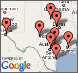
Current Projects in Texas
|
USGS Texas News
Scheduled Seminar Series
Please join us for these technical talks/WebEx sessions scheduled in the coming months.
No Seminars are scheduled at this time.
Map and directions to the Texas Water Science Center
 View all seminars
USGS Texas Job Listings
A number of new employment opportunities with the Texas Water Science Center are currently available.
View all job listings
Cooperating Agency Reports
CoreCast
Featured Publication
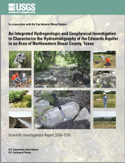
In August 2007, the U.S. Geological Survey, in cooperation with the San Antonio Water System, did a hydrogeologic and geophysical investigation to characterize the hydrostratigraphy (hydrostratigraphic zones) and also the hydrogeologic features (karst features such as sinkholes and caves) of the Edwards aquifer in a 16-square-kilometer area of northeastern Bexar County, Texas, undergoing urban development. Existing hydrostratigraphic information, enhanced by local-scale geologic mapping in the area, and surface geophysics were used to associate ranges of electrical resistivities obtained from capacitively coupled (CC) resistivity surveys, frequency-domain electromagnetic (FDEM) surveys, time-domain electromagnetic (TDEM) soundings, and two-dimensional direct-current (2D-DC) resistivity surveys with each of seven hydrostratigraphic zones (equivalent to members of the Kainer and Person Formations) of the Edwards aquifer. The principal finding of this investigation is the relation between electrical resistivity and the contacts between the hydrostratigraphic zones of the Edwards aquifer and the underlying Trinity aquifer in the area.
 Search our publications Search our publications
|
Spotlight on Texas Projects
The Texas Water Science Center conducts hydrologic projects that address a wide variety of water-resources issues, including water supply, groundwater contamination, nutrient loading in streams, effects of land use on water quality, and basic hydrologic data collection.
All Texas Projects
Featured Project:
The U.S, Geological Survey (USGS), in cooperation with the U.S. Department of Agriculture, Natural Resources Conservation Service, and in partnership with several state and local agencies, began a study in 1999 to evaluate the effects of ashe juniper (Juniperus ashei) control (removal) as a best-management practice (BMP) for increasing water quantity (aquifer recharge and streamflow) and protecting water quality in two watersheds located in the Honey Creek State Natural Area (HCSNA) in Comal County, Texas. In 2002, the study was expanded to include an additional watershed, Laurel Canyon Creek, located in the Government Canyon State Natural Area (GCSNA) in Bexar County, Texas.
- Hydrologic and water-quality data, Honey Creek State Natural Area, Comal County, Texas, August 2001-September 2003:U.S. Geological Survey Data Series 200
USGS Texas Highlights
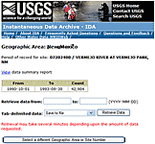 The Instantaneous Data Archive( The Instantaneous Data Archive( ) makes available as much intra-day streamflow data and historical instantaneous data continuous (measurements from every 5 to every 60 minutes), as possible, often several years' worth of data. ) makes available as much intra-day streamflow data and historical instantaneous data continuous (measurements from every 5 to every 60 minutes), as possible, often several years' worth of data.
|
|