Emergency Manager Briefing Information

(scroll down for more)

Click on the map below for the latest forecast.
Last map update: Sat, May. 9, 2009 at 10:31:25 pm CDT
Read watches, warnings & advisories
National Weather Service Sioux Falls, SD National Weather Service Twin Cities, MN National Weather Service La Crosse, WI
National Weather Service Omaha/Valley, NE
Zoom
Out

National Weather Service Quad Cities, IA/IL
National Weather Service Topeka, KS National Weather Service Kansas City/Pleasant Hill, MO National Weather Service St. Louis, MO
Hazardous Weather Outlook
Short Term Forecast
Radar and Satellite
(Click for larger images)

Link to Local Radar Data

Link to Satellite Image

BRIEFING MENU

Weather Story/Graphical Overview    Current Weather Map & Analysis    Current Satellite Image    Upper Midwest Radar Loop    Convective Outlooks 
 
  Central Iowa River Information    Hazardous Weather Outlook     Winter Weather Warnings/Watches/Advisories    Winter Precipitation Forecast
 
Winter Preparedness Information    Road Conditions (graphical)     Surrounding State's Road Condition Phone Numbers


                                                                             Weather Story/Graphical Overview

Image depicting current or forecast winter weather 


Current Weather Map's & Analysis


  Surface Analysis & Satellite (Loop)

Surface Analysis (Loop)

 Today's National Forecast

Image of Combined Surface Analysis & Satellite Image of Today's Current Weather - Animated Image of Today's National Forecast
 

                                                                      Current Surface Analysis 

Image of Weather Map


Current Surface Analysis & Satellite (Click on Image for Loop)

Image of Surface Analysis & Satellite
 

                                   Current Satellite Image (Click on Image for Loop)

Satellite Image


                              Upper Midwest Radar Loop

                   (click to enlarge - these images will open in a new window or tab)


Upper Mississippi Valley Radar Information


RADAR LINKS


   (click to enlarge - these images will open in a new window or tab)

Des Moines Radar

Kansas City Radar

Quad Cities Radar

Des Moines Radar

Kansas City Radar

Quad Cities Radar


La Crosse Radar

Minneapolis Radar

Omaha Radar

La Crosse Radar

Minneapolis Radar

Omaha Radar


CONVECTIVE OUTLOOKS

Day 1 Severe Weather Outlook

Day 2 Severe Weather Outlook

Day 3 Severe Weather Outlook

Day 4 - 8 Severe Weather Outlook

SPC Day 1 Convective Outlook Image

SPC Day 2 Convective Outlook Image

SPC Day 3 Convective Outlook Image

SPC Day 4 Through 8 Convective Outlook Image


 Day 1 Precipitation

 Day 2 Precipitation

  Current Watches


Image of Day 1 Precipitation

Image of Day 2 Precipitation

Image of Current Weather Watches


Day 1 Excessive Rainfall Forecast

Day 2 Excessive Rainfall Forecast

 Day 3 Excessive Rainfall Forecast

 River Flood Outlook

Image of Day 1 Excessive Rainfall Forecast Image of Day 2 Excessive Rainfall Forecast  Image of Day 3 Excessive Rainfall Forecast  Image of River Flood Outlook
       
 
Central Iowa River Information

(Advanced Hydrologic Prediction Service - Click on Map to Open new Window or Tab)

Central Iowa River Information


WINTER PRECIPITATION FORECAST 

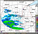
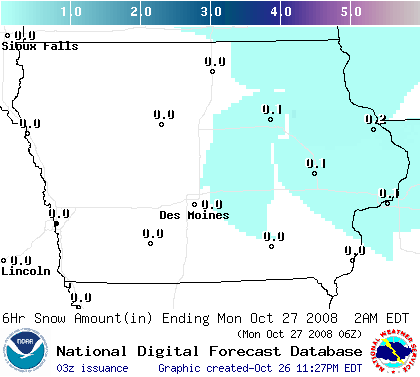
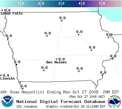
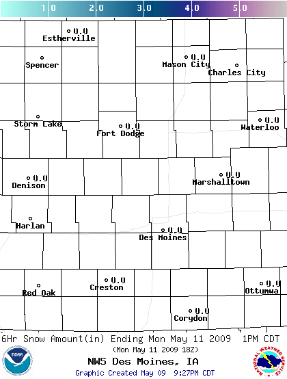
Central Iowa 0-6 Hour Snowfall

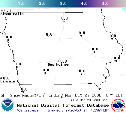
Central Iowa 6-12 Hour Snowfall

Central Iowa 12-18 Hour Snowfall

Central Iowa 18-24 Hour Snowfall

Image depicting 0 to 6 hour snowfall forecast

Image depicting 6 to 12 hour snowfall forecast

Image depicting 12 to 18 hour snowfall forecast

Image depicting 18 to 24 hour snowfall forecast

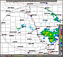
Central Iowa 24-30 Hour Snowfall Central Iowa 30-36 Hour Snowfall Central Iowa 36-42 Hour Snowfall Central Iowa 42-48 Hour Snowfall

 Central Iowa 24 to 30 Hour Snowfall Forecast

 Central Iowa 30 to 36 Hour Snowfall Forecast

 Central Iowa 36 to 42 Hour Snowfall Forecast

 Central Iowa 42 to 48 Hour Snowfall Forecast


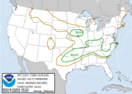
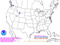
Day One - Four Inch Snowfall Probability

Day Two - Four Inch Snowfall Probability

Day Three - Four Inch Snowfall Probability

 
Image of Day 1 Four Inch Snowfall Probability Image of Day 2 Four Inch Snowfall Probability Image of Day 3 Four Inch Snowfall Probability  
       

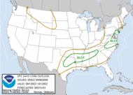
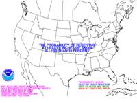
Day One - Eight Inch Snowfall Probability

Day Two - Eight Inch Snowfall Probability

Day Three - Eight Inch Snowfall Probability

 
 Image of Day 1 Eight Inch Snowfall Probability  Image of Day 2 Eight Inch Snowfall Probability  Image of Day 3 Eight Inch Snowfall Probability  
       

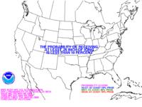
 Day One - Twelve Inch Snowfall Probability      

Day Two - Twelve Inch Snowfall Probability      

Day Three - Twelve Inch Snowfall Probability      

 
 Image of Day 1 Twelve Inch Snowfall Probability  Image of Day 2 Twelve Inch Snowfall Probability  Image of Day 3 Twelve Inch Snowfall Probability  
       

 Day One - Freezing Rain Probability     

Day Two - Freezing Rain Probability     

Day Three - Freezing Rain Probability     

 
 Image of Day 1 Freezing Precipitation Probability  Image of Day 2 Freezing Rain Probability  Image of Day 3 Freezing Rain Probability  


  • National Weather Service
  • Des Moines, IA Weather Forecast Office
  • 9607 NW Beaver Drive
  • Johnston, IA 50131-1908
  • 515-270-2614
  • Page Author: DMX Webmaster
  • Web Master's E-mail: w-dmx.webmaster@noaa.gov
  • Page last modified: 15-Jan-2009 9:23 PM UTC
USA.gov is the U.S. government's official web portal to all federal, state and local government web resources and services.