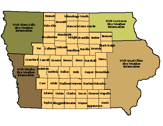
Fire Weather Planning Forecasts
Click a shaded county from the map below to view the Fire Weather Planning Forecast
from NWS Des Moines. Fire weather forecasts are updated once daily by 6 a.m. local time.
Spot Forecasts
Forecast Narratives
Helpful Maps from NIFC (National Interagency Fire Center)
Other Links
Glossary of Terms
- Mixing Height: Depth of the surface based layer of the atmosphere in which mixing occurs.
- Transport Wind: Average wind between the surface, or the 20 feet level, and the wind at the forecast mixing height.
- 20 Feet Wind: Wind speed at 20 feet above ground level.
- Haines Index: A stability and moisture index used to indicate the potential for fire growth, and more importantly extreme fire growth.
|