|
|
|
|

| Fire Weather Forecasts | |||
|
|
Click on the image to the left to view a larger map of the WFO Amarillo Fire Weather Zones! |
|

| Red Flag Fire Weather Products and Info | ||
|
|
|

| Fire Danger Statements | |
| Fire Warning | ||
|
||
| Spot Forecasts | ||
|
Texas and Oklahoma Panhandles |
|
| NFDRS Forecasts | |||||||
|
|
||||||
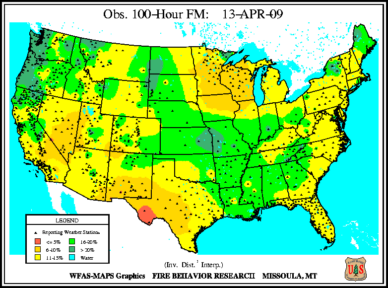
| NFDRS Observations | |
|
|
| Fire Weather Point Forecast Matrices | ||
|
||
| IMET Resources | |
|
| Miscellaneous | ||
|
||
To Calculate Relative Humidity or Other Meteorological Conversions - Please Click HERE
Please direct your Fire Weather questions and comments to our program
leader Ken Schneider.