Severe Weather BriefingHeavy rain and flooding briefingRadar and current weather briefingForecast weather briefingWinter Weather BriefingRecreational Weather BriefingHeat BriefingDrought BriefingWind Chill Briefing

Radar and Current Conditions - Briefing Page

Radars:
[ICT]  [EAX]  [LSX]
[INX]  [SGF]  [PAH]
[SRX]  [LZK]  [NQA]

Weather Activity Planner
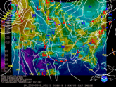
Short Term Outlook  Visible Imagery Water Vapor Surface Maps Long Term Outlook
CONUS Regional CONUS CONUS


Hazardous Weather OutlookSpotter Outlook
[Spotter Outlook]  [Tornado Threat]
[T-Storm Wind Threat]  [Hail Threat]
[Flood Threat]  [Non-Precip. Threats]
[Winter Weather]  [Fire Weather]

Precipitation Forecast
Precipitation Forecast Map
[Day 1]   [Day 2]   [Day 3]
[5 Day Total]


Thunderstorm Forecast

[Day 1 - 0100Z]  [Day 1 - 1200Z]
[Day 1 - 1300Z]  [Day 1 - 1630Z]

Graphical Forecast
Graphical Forecast Image
Local   |  Regional  |  National

Forecast Map
Forecast Weather Map
12 hr 24 hr  |  36 hr  | 48 hr


  • National Weather Service
  • Springfield, MO Weather Forecast Office
  • Springfield-Branson Regional Airport
  • 5805 West Highway EE
  • Springfield, MO 65802-8430
  • 417-869-4491
  • Page Author: SGF Webmaster
  • Web Master's E-mail: w-sgf.webmaster@noaa.gov
  • Page last modified: December 6th 2008 10:11 AM
USA.gov is the U.S. government's official web portal to all federal, state and local government web resources and services.