March 1st 2007 Tornadoes and Severe Storms
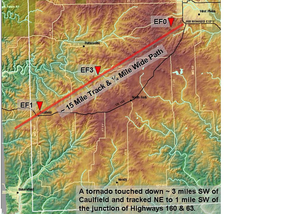
Severe thunderstorms rumbled through the Missouri Ozarks early Thursday morning March 1st. Hail, damaging winds, and isolated tornadoes were reported. A confirmed tornado tracked from southeast Ozark County into Howell County early Thursday morning including Caulfield.
Ozark County - Howell County Tornado Track
|
Tornado Rating |
EF3 |
|
Tornado Track |
15 miles |
|
Tornado Width |
1/4 mile |

Tornado Photo from near West Plains (7 miles out on Hwy K)
Photos of some tornado damage from the Caulfield storm.
Radar Images


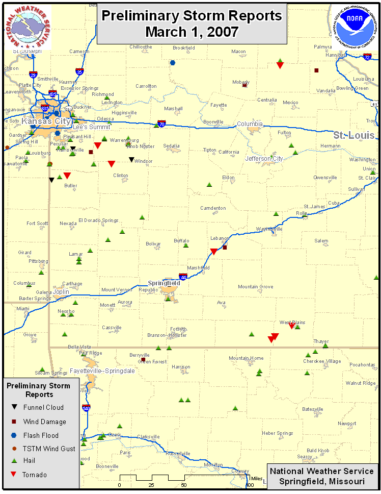
Preliminary Storm Reports
The map below depicts preliminary storm reports collected by the National Weather Service. The National Weather Service in Springfield, Missouri would like to thank all of the trained weather spotters, general public, media, emergency management and law enforcement who submitted storm reports.
Hailstones from severe storm in Thayer, MO
|
|
|


More information
For more information on the new Enhanced Fujita Scale click here.
For more storm reports across the nation click here.