Severe Weather BriefingHeavy rain and flooding briefingRadar and current weather briefingForecast weather briefingWinter Weather BriefingRecreational Weather BriefingHeat BriefingDrought BriefingWind Chill Briefing

Heavy Rain and Flooding - Briefing Page

Low Water Crossings Map
Springfield, MO Radar
AHPS Monitor
Short Term Outlook  Visible Imagery Water Vapor Surface Maps Long Term Outlook
CONUS Regional CONUS CONUS


Hazardous Weather OutlookHeavy Rain Flood Outlook
[Flood Threat] 
[Day 2]  [Day 3]  [Day 4] 


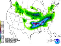
Precipitation Forecast
Precipitation Forecast Map
[Day 1]   [Day 2]   [Day 3]
[5 Day Total]

Excessive Rainfall OutlookExcessive Rainfall Outlook
[Day 1]  [Day 2]  [Day 3] 
[Discussion] 


 Forecast Map
Forecast Weather Map
12 hr 24 hr  |  36 hr  | 48 hr


  • National Weather Service
  • Springfield, MO Weather Forecast Office
  • Springfield-Branson Regional Airport
  • 5805 West Highway EE
  • Springfield, MO 65802-8430
  • 417-869-4491
  • Page Author: SGF Webmaster
  • Web Master's E-mail: w-sgf.webmaster@noaa.gov
  • Page last modified: December 6th 2008 10:00 AM
USA.gov is the U.S. government's official web portal to all federal, state and local government web resources and services.