skip navigation link
 NOAA > NESDIS > NGDC > MGGD > marine geology & geophysics
mgg ship, core, seismic collage
NGDC is data management lead for the US effort to explore potential extended continental shelf areas.

Related Data at NGDC:
Geomagnetism
Gravity
Natural Hazards
Topography
Tsunami/Tides


Marine Geology & Geophysics

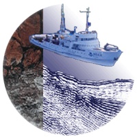
The National Geophysical Data Center provides scientific stewardship, products and services for sea floor and lakebed data, including geophysics (gravity, magnetics, seismic reflection, bathymetry), and data derived from sediment and rock samples.
Marine Geophysics
line
All geophysics magnetics
search for data sediment thickness
create custom grids seismic reflection
gravity trackline geophysics

Marine Geology
line
All geology Index to Geological Samples
search for data ocean drilling data
crustal ages well logs

Ocean Depths (Bathymetry)
line
All bathymetry hydrographic surveys
coastal grids IHODCDB
coastlines international ocean mapping
ETOPO1, global grids multibeam bathymetry
fishing maps trackline
Great Lakes tsunami inundation
NGDC compiles coastal and global digital elevation models, high-resolution models for tsunami inundation studies, provides stewardship for NOS data supporting charts and navigation, and is the US national long-term archive for MGG data.
Learn more about mgg activities or the MGG Division.

What's New in MGG?

Frequently Asked Questions

Educational Resources

ocean ages image
2008 Ocean Ages Data

More Age Grid images

sediment thickness image
Sediment Thickness of the Oceans

Pacific Relief Globe
Images & Animations

Posters, DVDs, & CDs

Related External Sites