|
|
|
Metadata
|
|
ID
|
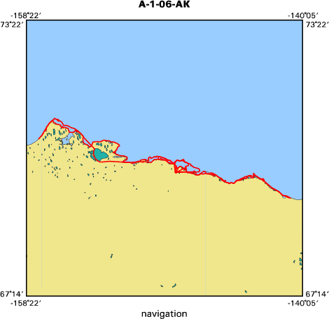
A-1-06-AK
|
|
Abstract
|
United States Geological Survey, Pacific Science Center.
Chief Scientist: Bruce Richmond. Aerial Photography and Video
data (Digital camera, MiniDV video camera) of field activity
A-1-06-AK in North Slope of Alaska from 08/07/2006 to
08/11/2006
|
|
Organization
|
United States Geological Survey, Pacific Science Center
|
|
Project/Theme
|
National Assessment of Shoreline Change
Coastal Change Hazards
|
|
Chief Scientist
|
Bruce Richmond
|
|
Activity Type
|
Aerial Photography and Video
|
|
Platform
|
Airplane
|
|
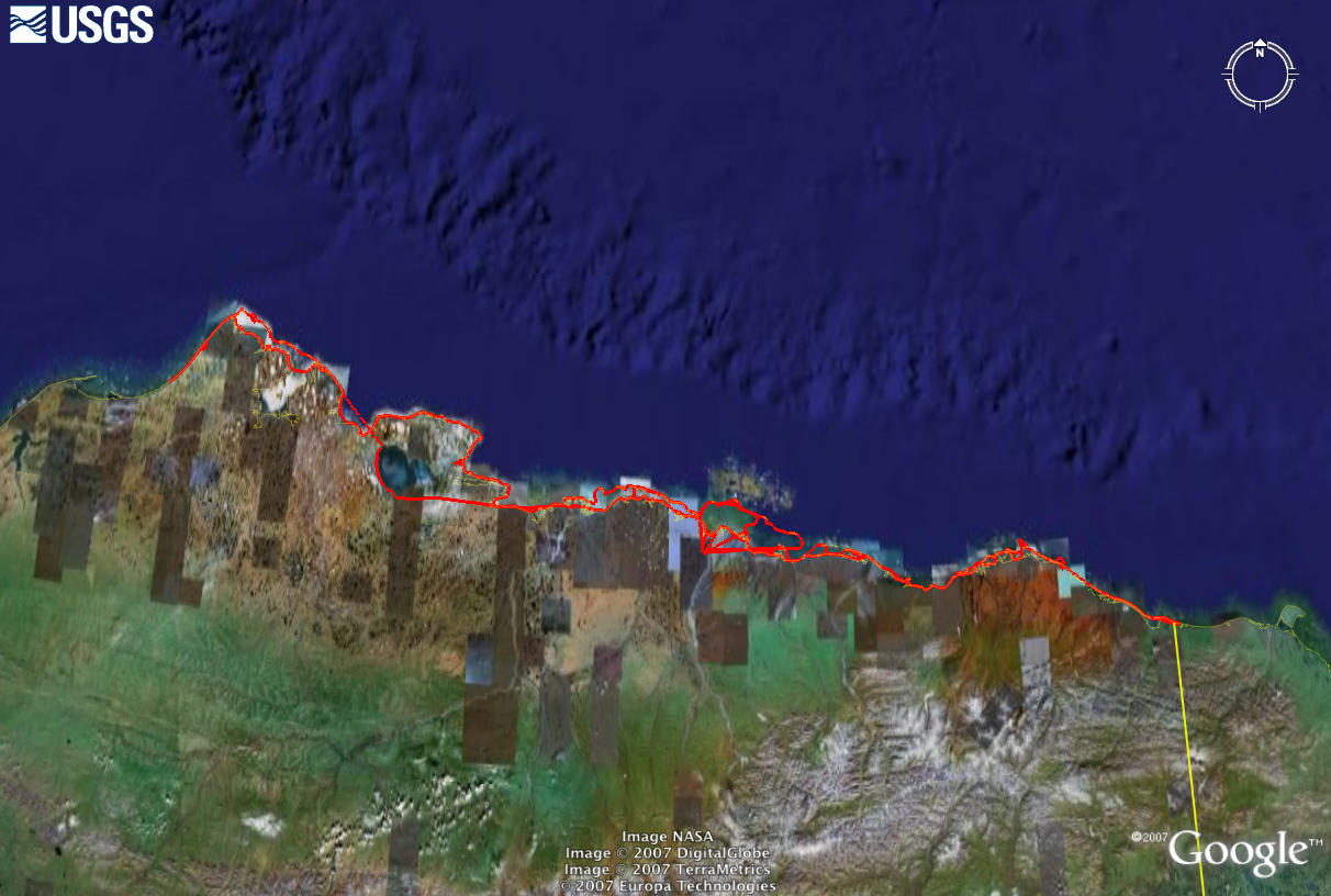
Area of Operation
|
North Slope of Alaska
|
|
Location map
|
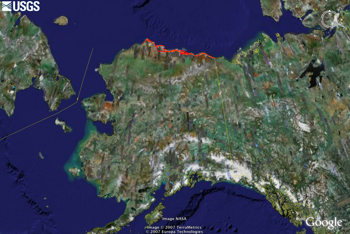
|
|
Bounding Coordinates
|
74.75000
165.25000 -125.25000
45.25000
|
|
Ports
|
LEAVE Deadhorse, Alaska
ARRIVE Deadhorse, Alaska
|
|
Dates
|
08/07/2006 (JD 219) to 08/11/2006 (JD 223)
|
|
Analog Materials
|
No analog holdings.
|
|
Index maps

|
|
|
Information Specialist
|
|
|
Crew
|
|
Bruce Richmond
|
digital photography
|
|
Ann Gibbs
|
videography
|
|
Jim Webster
|
pilot
|
|
|
Equipment Used
|
|
Digital camera
|
|
MiniDV video camera
|
|
|
Purpose
|
|
Reconnaissance investigation of new study area
|
|
|
Information to be Derived
|
|
Georeferenced photographic and video images
|
|
|
Summary
|
|
Oblique airborne imagery will be gathered to document regional coastal
|
|
morphology as part of the National Assessment of Shoreline Change project.
|
|
|
Notes
|
|
National Assessment of Shoreline Change Project, on-line at:
|
|
Coastal & Marine Geology Program
|
|
|
|
National Assessment of Shoreline Change Project, Alaska, on-line at:
|
|
|
|
target="ak"> Alaska Science Center
|
|
|
|
Gibbs, Ann, and Richmond, Bruce, North to Alaska --an Aerial Shoreline
|
|
Reconnaissance, October 2006 Sound Waves,
|
|
|
|
http://soundwaves.usgs.gov/2006/10/fieldwork2.html
|
|
|
Got Help?
|
For A-1-06-AK, we would appreciate any information on -- analog materials, contract, days at sea, dive count, funding, kms of navigation, national plan, NGDC Info, owner, project number, publications, scanned materials, seismic description, station count, station description, submersible, tabulated info.
|
|