 |
 | |
  | |
|
|
|
|
Big Bend National Park
Day Hikes in the Backcountry
|
|
|
|
|
| |
 |
Into the wildest places of Big Bend
|
 |
| Standing above Ernst Tinaja |
 |
Ernst Tinaja
1.4 miles roundtrip
A short walk up a sandy wash leads to a canyon of highly-convoluted rock layers. The large natural tinaja holds water all year long. Be careful near the tinaja's edge. Over the years deer, javelina, and even mountain lions have been found drowned in this tinaja. The trailhead is located off the Old Ore Road, 5 miles from the southern end near Rio Grande Village. High clearance vehicles are necessary to reach this enjoyable trail. A primitive campsite is located near the trailhead.
|
 |
| At the base of the pour-off |
 |
Pine Canyon Trail
4 miles roundtrip
This beautiful hike begins at the very end of the Pine Canyon primitive road. A high-clearance vehicle is necessary to reach the trailhead. The trail gradually climbs through open desert grasslands for one mile before entering the actual canyon. Once in the shelter of the canyon, hikers are rewarded by a shady woodland comprised of Pinyon and Ponderosa pine, oaks, maple, and Texas madrone. The trail ends at the base of a 200-foot cliff that becomes a dramatic waterfall after any rain.
|
 |
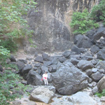
| Park Ranger standing beneath the balanced rock, 1950s |
 |
Grapevine Hills Trail
2.2 miles roundtrip
An easy hike up a sandy wash surrounded by massive boulders. After 1 mile the trail ascends to a low saddle at the end of the drainage. Follow the signs to locate the giant "window" of boulders. This is one of the most picturesque spots in all of Big Bend NP. Kids love this trail! The trailhead is located 7 miles down the Grapevine Hills Primitive Road. Ask a ranger about current road conditions.
|
 |
| On the rim of Mariscal Canyon |
 |
Mariscal Canyon Rim Trail
6.6 miles roundtrip
The drive to the trailhead is long and dusty, but once you begin to hike, the spectacular views of the Rio Grande and superlative cliff walls of Mariscal Canyon will make it all worthwhile. This trail begins at the end of the Talley Road via the River Road. It will take you at least 2 hours of driving on rough dirt roads to reach the small parking area that denotes the trailhead. There are four primitive roadside campsites located along the Talley Road. Be sure to have plenty of water with you, because this hike is hot and there is NO shade anywhere along the way. The first 1.5 mile is easy and level, but the last 1.8 miles is extremely steep as it climbs straight up to the top of Mariscal Canyon. The views here are unsurpassed, and the sheer drop-off will challenge your senses.
Informational handout regarding the Mariscal Canyon Trail [1.78Mb PDF File]
|
 |
| Two hikers dwarfed by the landscape of the Mesa de Anguila |
 |
The Mesa de Anguila
Rugged, primitive, hard to access, and spectacular Situated along the far western boundary of Big Bend National Park, the Mesa de Anguila is rarely visited by park visitors. The mesa forms the right hand (U.S.) side of Santa Elena Canyon. It is a high uplift that extends well into Mexico. This area is for experienced hikers/backpackers only. The 7.5 minute USGS topographic map of the Mesa is essential, as are good map reading skills. The various trails are primitive and sometimes hard to follow. Water is always a problem on the mesa. Although there are several tinajas, they are frequently dry. What the Mesa de Anguila does offer is unsurpassed solitude, spectacular vistas, and magnificent desert wildness. Stop by park headquarters for more information on how to access the mesa and suggested routes.
Click here for more information on the Mesa de Anguila...
|
|  |
|
|

Survive the Sun
What you need to know about heat safety
more... | | 
The Daily Report
Weather, campground updates, river levels and other information about what's happening in the park
more... | | 
The Backcountry
Big Bend's backcountry areas provide excellent opportunities for hiking, floating, and camping.
more... | | 
Park Maps
Chart Your Course
more... | |
|
|
|
|
|
|
|
 |
|
Did You Know?
According to legend, a lost Spanish mine is located in the Chisos Mountains. The Conquistadors used the Presidio de San Vicente as a prison and from there worked a mine in the area. The guards blindfolded the captive Indians and marched them from the Presidio to the mine, supposedly in the Chisos.
more...
|
|
|
|
Last Updated: December 20, 2007 at 11:38 EST |


