 |
 | |
  | |
|
|
|
|
Big Bend National Park
Day Hikes in the Chisos Mountains
|
|
|
|
|
| |
 |
Chisos Mountain Area Dayhikes
|
|
NOTE: Smoking is prohibited on all trails in the Chisos Mountains.
|
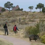 |
| The Window View Trail is a short and easy walk |
 |
The Window View Trail
.3 miles roundtrip
This paved trail begins at the Chisos Basin Trailhead area and circles the low hill to the west. Benches are located at a number of placed along the trail. This trail provides one of the better sunset views in the park. Handicapped accessible.
|
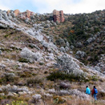 |
| A frosty day on the Lost Mine Trail |
 |
The Lost Mine Trail
4.8 miles roundtrip
This moderately difficult trail begins at mile marker 5 along the Basin Road. With it's accompanying trail guide (available at the trailhead), this is an excellent introduction to the plants and animals of the Chisos Mountains. The trail starts at an elevation of 5,600' and steadily climbs to the top of a 6,850' promontory overlooking Pine and Juniper Canyons. If you don't want to hike the whole way, one of Big Bend's greatest viewpoints is at the end of the first mile. Take a lunch and enjoy the sights and sounds of the High Chisos
|
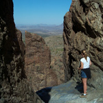 |
| Joe Rossi | | At the Edge |
 |
The Window Trail
4 miles roundtrip
This trail begins from the Basin Campground near site #52. This trail is unique in Big Bend in that it descends 800 feet from the trailhead for two miles. Hikers then must gradually ascend on the way back. The first mile is through open scrub vegetation with fantastic views of surrounding Chisos peaks. The last mile enters a cool shady canyon with oaks, wildflowers, and a sometimes a trickle of water. At the end of the trail is the "window"...the pour-off that drains the entire Chisos Basin. It is a narrow slot in the canyon wall at the top of a 200 foot dropoff. This trail is a good one for viewing wildlife. Hikers frequently see javelina, gray fox, and sometimes even black bears. For an extra treat, take the Oak Spring Trail which veers off near the end of the Window Trail. Take this side trail for 1/4 mile to a point above the actual window. The panoramic view from this high vantage point is spectacular.
|
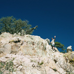 |
| Scrambling to the Summit |
 |
Emory Peak
9 miles roundtrip
This is a 9 mile roundtrip hike to the highest point in Big Bend National Park (7,832'). The last 25 feet require a scramble up a sheer rock wall, but your reward is the ultimate panoramic view! From the Basin Trailhead take the Pinnacles trail for 3.5 miles. At this point, the one mile trail to the summit cuts off and heads upward. For fantastic views and solitude, this trail is hard to beat! Most hikers require approximately 5-6 hours for the roundtrip journey.
|
 |
| Standing at the Edge of the World |
 |
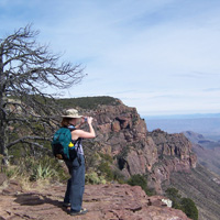
The South Rim
12 miles roundtrip
The South Rim is located at the extreme southern edge of the Chisos Mountains. At the rim, the desert floor lies 2,500 feet below you and vast panoramas of rugged desert and mountains beckon far into Mexico. The South Rim can be done as a strenuous day hike, but is best enjoyed on a 1-2 night backpack trip. Backcountry campsites are available with a backcountry permit. Hikers may make a great loop by taking the Pinnacles Trail up and the Laguna Meadow Trail down, or vice versa.
|
|  |  |
|
|

Survive the Sun
What you need to know about heat safety
more... | | 
Texas' Gift to the Nation
Learn more about how Big Bend was established.
more... | | 
Ranger-led programs
Join a park ranger to learn more about Big Bend
more... | | 
Chisos Basin Weather
Automated Station—updated hourly
more... | |
|
|
|
|
|
|
|
 |
|
Did You Know?
Robert Hill, working for the U.S. Geological Survey, was the first person to successfully float the canyons of the Rio Grande in the area of Big Bend. His trip, from Presidio to Lantry took over a month.
|
|
|
|
Last Updated: October 31, 2007 at 11:27 EST |


