|
Isochron map showing maximum downwind extent of ash from airborne-ash plume
erupted from Mount St. Helens on May 18, 1980, and carried by fastest moving
wind layer, as observed on satellite photographs. Map is compiled from NOAA
satellite photographs (sectors KB9 and SA40) taken at half-hour intervals
between 0845 and 1816 PDT. Plot of plume position relative to ground was
visually corrected for zenith angle. Probable error in position of plume
boundaries is +/- 10 kilometers in the north-south direction, and +/- 5
kilometers in the east-west direction.
-- Modified from: Sarna-Wojcicki, et.al., 1981, Areal Distribution, Thickness, Mass, Volume, and Grain Size of Air-Fall Ash from the Six Major Eruptions of 1980: IN: Lipman, P.W., and Mullineaux, D.R., (eds.), The 1980 Eruptions of Mount St. Helens, Washington: U.S. Geological Survey Professional Paper 1250 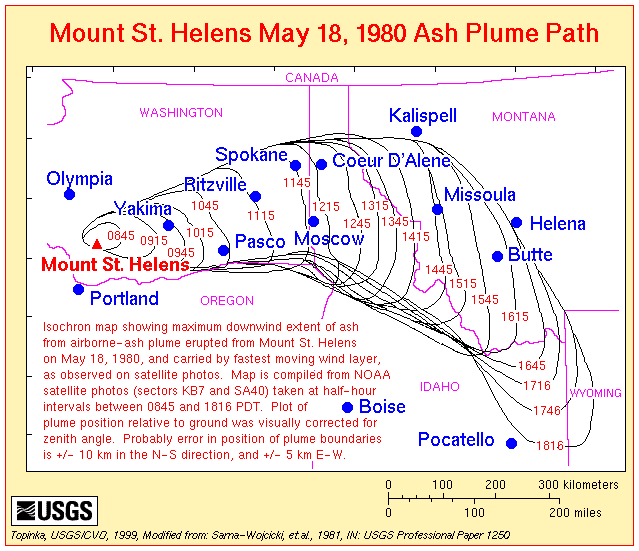
|
Return to:
[Report Menu] ...
[Mount St. Helens Menu] ...
[Mount St. Helens May 18, 1980 Menu] ...
[Mount St. Helens Ash and Tephra Menu] ...
