


Early Warning System Forecasts Deadly Mudslides

Debris-flows can occur quickly and trap or kill unsuspecting victims in their path.
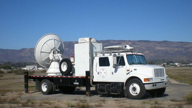
High resolution (Credit: NOAA)
Many people living throughout much of the continental United States may not be too concerned about a wall of mud, water, and debris swallowing up their homes and potentially endangering their lives, but those living near wildfire burn areas in regions such as Southern California may tell another story.
In the United States, approximately 25 to 50 deaths a year can be attributed to the phenomenon of debris flow — or mudslides as they are more commonly known — with monetary losses exceeding $2 billion annually (National Resource Council, 2004).
These gravity-driven mixtures of sediment, water, and other dislodged objects are caused by heavy rainfall or rapid snowmelt, and weakened terrain, creating a deadly slurry of dislodged rocks, soil, and trees. These ingredients combine to resemble a wet concrete-like mass that can develop tremendous downhill force and leave a path of destruction in its wake.
New Prediction Technologies

The U.S. Geological Survey, working closely with National Oceanic and Atmospheric Administration scientists from the National Weather Service Office of Hydrologic Development, NWS forecast offices at Oxnard, San Diego and Monterey, Calif., the Earth Systems Research Laboratory, and the National Severe Storms Laboratory in Norman, Okla., developed a prototype debris flow warning system using weather forecasts and precipitation measurements along with regional USGS rainfall rate thresholds to determine the probability of debris flows.
“Important science and technological advances suggest the time is right to develop an operational warning system,” said Jayme Laber, NWS hydrologist. “With more detailed and accurate weather and hydrological forecasts available the opportunity for a formal, operational debris-flow forecast warning system seemed evident.”
Vital Information for Communities Affected by Forest Fires

Starting in 2005, a team comprised of geologists, hydrologists, and meteorologists selected recent burn areas outside Burbank, Calif., as the testbed for a three-year study. Extensive wildfires, mountainous terrain, and ideal meteorological conditions in the region (strong winds and drought conditions in the lower regions and heavy snow or rainfall in upper-elevations) provided favorable conditions for debris flows and a perfect research testbed.
As a result of the prototype study, a warning system similar to that used by the NWS to include outlooks, watches, and warnings was developed. Outlooks, which include information about potential hazards from burned areas, are often issued before the onset of winter storms — providing considerable lead time to prepare for potential dangers. Watches are typically issued up to six to twelve hours before the potential for a debris flow event. Warnings are issued when the threat of hazardous weather is occurring, or has a very high probability of occurring, resulting in a serious threat to life and property.
“Resulting data from the prototype has been received enthusiastically by the emergency management community,” said David Jorgensen, NOAA research meteorologist. “This system has provided valuable information to emergency managers in communities affected by forest fires and has emergency managers in other parts of the country requesting extension of the system to include their communities.”

Real-Time Data for Advanced Warning
To obtain accurate research data in the mountainous terrain, mobile Doppler weather radar and vertical wind profilers from ESRL’s Hydrometeorological testbed are used in burn areas to augment NWS network radar data along with measurements collected from USGS rain gauges, topographic data, soil moisture sensors, surface runoff sensors, and video cameras. This data helps scientists develop high-resolution rainfall models and debris-flow models. These data sets are transmitted in real time to the NWS forecast offices so the latest information can be used in debris-flow warning decisions.
Plans for the warning system include new or improved ways to define how much rain various soil conditions can absorb before becoming unstable, estimates of when debris-flow may occur, and linking real-time monitoring of precipitation and hill slope conditions with advanced models. While the current system is designed to work in areas that have lost a lot of ground and tree cover to fire, the system could be expanded to include areas untouched by fire nationwide.
To learn more about debris flows, visit the National Severe Storms Laboratory Debris Flow Web site. ![]()