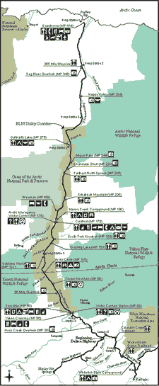
Maps of the Dalton Highway
| |  |
| | Click on map for larger version |
The map on the right shows key points along the Dalton Highway as well as recreational facilities such as campgrounds, overlooks and visitor centers. Click on the map for a larger version suitable for screen viewing. An even larger, printable version of this map is available in PDF format (394 KB), viewable with free Adobe Acrobat Reader software. Also available for downloading are maps of Coldfoot and Wiseman (PDF, 118 KB) Other sources of maps
Topographic maps are available for sale at the Geophysical Institute's Map Office on the University of Alaska Fairbanks campus. Road maps of Alaska may be found at the Fairbanks Convention and Visitors Bureau, located in downtown Fairbanks.