Center for Spatial Analysis Technologies
|
Georgia Tech and the United States Geological Survey
(USGS) combined efforts in 1991 to establish joint "Centers for
Spatial Analysis Technologies". The Centers house interdisciplinary
teams working together in three aspects of spatial analysis
technologies: education, service, and research. The centers represent a
commitment by USGS and Georgia Tech to explore synergistic partnership
in the application of technology to environmental sciences. Spatial data
sets for Georgia are available from the following links: |
|

|
New Release The Statewide Topographic and Orthophotographic Map Viewer (State TopoViewer) is a DVD-ROM published by the Georgia Department of Natural Resources (GA DNR), Environmental Protection Division (EPD) in cooperation with the USGS. It contains all of the 1:24,000 scale topographic maps for the state of Georgia, as well as imagery, and searchable location information. State TopoViewer |
|
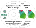
The Digital Environmental Atlas of Georgia is a CD-ROM set published by the Georgia Department of Natural Resources (GA DNR), Environmental Protection Division (EPD), Geologic Survey Branch in cooperation with the USGS. The CD-ROM set contains 38 digital map data sets covering the State of Georgia. The Digital Environmental Atlas of Georgia |

|
Digital topographic maps (Digital Raster Graphic or DRG images) at 1:250,000-Scale, 1:100,000-Scale, and 1:24,000-Scale may be viewed as thumbnail images or downloaded Digital Raster Graphics |

|
USGS-GDNR spatial data may be viewed on-line through an Internet Map Server (IMS). Two applications, The Digital Environmental Atlas of Georgia and 1:24,000-Scale Digital Raster Graphic are available through the IMS. Internet Map Server |

|
The statewide environmental resources database, a cooperative project of the USGS and the GA DNR, is composed of digital thematic data layers ranging in scale from about 1:24,000 to 1:500,000. Federal Geographic Data Committee compliant metadata may be viewed and spatial data may be downloaded, viewed as maps or thumbnail images. Maps, Metadata and Data downloads |

|
Spatial data developed by the GA DNR, EPD in cooperation with the USGS to support River Basin Management Planning are available for download. The data are arranged by major basin and hydrologic unit. Watershed Data |
| Representatives of the USGS have served since 1988 on the State Mapping and Advisory Board, and since 1996 on the GIS Coordinating Committee, and currently work cooperatively with the Georgia GIS Clearinghouse. This involvement has led to the State of Georgia’s cooperative effort with USGS in the development of NAPP photography, B&W and CIR Digital Orthophoto Quadrangle production, DRG topographic maps, and statewide hydrography and transportation base map work. | |

![]() U.S. Department of the Interior |
U.S. Geological Survey
U.S. Department of the Interior |
U.S. Geological Survey
URL: http://csat.er.usgs.gov/statewide/index.html
Page Contact Information: webmaster-ga@usgs.gov
Page Last Modified: Thursday, 18-May-2006 14:27:07 EDT
