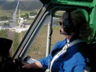
| Gulfstream
IV-SP (G-IV)

The
Gulfstream IV-SP (G-IV) is a high altitude, high speed,
twin turbofan jet aircraft acquired by AOC in 1996.
The G-IV is currently configured for operational support
of the National Hurricane Center synoptic surveillance
mission and is expected to provide support for NOAA
programs for many years to come. This mission is designed
to collect, process and transmit vertical atmospheric
soundings in the environment of the hurricane. The principle
tool used for this task is the GPS dropwindsonde.
The dropsonde is released from the G-IV measuring and
transmitting back to the aircraft the pressure, temperature,
humidity, and GPS Doppler frequency shifts as it descends
to earth. The Doppler shifts are used to compute the
horizontal and vertical wind components. After analysis
and processing of the dropsonde data the information
is formatted into a TEMP-DROP message using the standard
WMO format. The TEMP-DROP message is then transmitted
to the National Centers for Environmental Prediction
and the National Hurricane Center for inclusion into
the global and hurricane model runs. The TEMP-DROP message
is also provided to the hurricane forecaster providing
real-time observations depicting the synoptic patterns
surrounding the hurricane.

Gulfstream
G-IV SP (Special Performance)
Gulfstream
G-IV SP Transformation Article
STANDARD
AIRCRAFT SPECIFICATIONS
| Engines:
|
Two
Fuselage Mounted Rolls Royce Tay 611-8 twin spool
turbofan jet engines |
| Crew: |
(Hurricane
and Winter Storm Missions):
2 pilots
1 flight engineer/mechanic
1 flight meteorologist (flight director)
1 High Altitude Profiling System (HAPS) system operator
(can be automated)
3 Engineering Technicians/Dropwindesonde (Sonde)
system operators |
| Ceiling:
|
45,000
feet |
| Rate
of Climb (approximate - fully loaded): |
3000
fpm (first 25000 ft.)
1500 fpm (through 33000 ft.)
1000 fpm (to 41,000 ft. – max wt. ceiling) |
| Operational
Airspeeds: |
41,000
– 45,000 ft. True Airspeeds (Mach .77-.80,
440-460 kts.) |
| Electrical:
|
Two
engine driven alternators (36KVA, 115 volt, unregulated
3 phase)
One Auxiliary Power Unit (APU) (36KVA, 115 volt,
400Hz, 3 phase)
Two Converters (converts and regulates engine alternator
power)
Each provides: 23KVA, 400Hz, 3 phase AC power
250 amps, 28 volts DC power |
| Scientific
Power: |
SED
has an Uninterruptable Power Source (UPS) for scientific
gear |
| Max.
Gross Weight: |
Ramp
75,000 pounds
Takeoff 74,600 pounds
Landing 66,000 pounds |
| Empty
Weight: |
43,700
pounds
(operational configuration) |
| Useful
Load: |
31,300
pounds
(operational configuration) |
| Fuel
Load: |
29,500
pounds |
| Type
Fuel: |
Jet
A, JP4, JP5, JP8 |
| Standard
Fuel Burn: |
(fully
loaded) = 5000 pounds/hr for first hour and 3000
pounds/hr for every hour after that |
| Maximum
Range: |
3800
nm. (with a 1 hour fuel reserve) |
| Maximum
Duration: |
8
hrs. 45 minutes (with 1 hour fuel reserve) |
| External
Dimensions: |
Radome
to trailing edge of horizontal stabilizer = 87.58
ft.
Radome to aft end of fuselage = 78.83 ft.
Wing Span = 77.83 ft.
Horizontal Tail Span = 32 ft.
Vertical Tail Height = 24.4 ft |
| Internal
Dimensions: |
Head
Room = 6ft.
Bulkhead to Bulkhead = 8 ft.
Cabin Length (Cockpit to Baggage Comp.) = 33 ft. |
| Useable
Volume: |
Usable
Length = 33 ft.
Usable Width = 6 ft.
Usable Height = 4 ft.
Usable Volume = 792 cubic ft. |
| Additional
Standard Equipment |
| Cockpit:
|
2
High Frequency (HF) Radios
2 VHF Radios
Honeywell SATCOM Phone
GPS and Inertial Reference Systems (IRS) for navigation
1 UHF Radio
Honeywell TCAS II System (with FAA Change 7)
EROS Quick Donning Oxygen System
Collins WXR-700C (C-band weather radar) |
| Cabin:
|
Dropwindesonde
Tube with 8-channel tracking capability
Satellite Communication System with voice/data transmission
capability
Numerous Computer Systems |
The
specific equipment and systems onboard the G-IV for
the hurricane surveillance mission are the:
- Main
Aircraft Data System
- Two Data System Modules for instrument interface
and data collection
- Four Networked Sun Sparc5 Workstations
- Extensive atmospheric instrumentation
-
Airborne Vertical Atmospheric Profiling System
- Dropsonde Data System for drop execution, data collection
and storage
- Dropsonde Launch Chute
- GPS dropwindsonde
- Hurricane
Analysis and Processing System
- Workstation accomplishes data analysis, processing,
and message formatting
- Internal/External
communication system
- VHF, UHF, ADF, Flight Phone, SATCOM and Passenger
Communication System
- Rockwell
Collins WXR-700C C-Band Weather Radar w/ 30-inch antenna
The
G-IV aircraft is on standby or deployed 180 days for
hurricane surveillance, another 30-60 days are required
for instrumentation and calibration, and 30 days for
maintenance and training while anticipating between
200 to 300 hours of flying every year.
NOAA
G-IV Winter Storms Reconnaissance
In
order to more accurately predict the location and intensity
of high winds, destructive surf conditions, severe weather
and flooding rainfall caused by winter storms, the NOAA
National Centers for Environmental Prediction (NCEP)
instituted the Winter Storms Reconnaissance (WSR) program
in 1998. Each year since then, the NOAA G-IV has served
WSR from bases in Anchorage, AK and Honolulu, HI. In
2003, the G-IV will base from Hawaii, conducting approximately
20 missions over the North Pacific, into the breeding
grounds of these future US-bound storms.
Over the years, NOAA NCEP has developed a method called
targeted observations, whereby the NOAA jet is directed
in advance to regions of the atmosphere where storm
prediction models indicate enhanced data will have the
most positive influence on the forecast accuracy. Once
over these locations, dropwindsondes are launched to
provide vertical soundings of the atmosphere between
the aircraft and the ocean’s surface. Targeted
observations have proven themselves in more than 90%
of storm cases, generally improving the accuracy of
storm track and intensity prediction between 10% - 20%.
Another way to judge the public impact is that quantitatively,
these additional observations from the G-IV result in
giving emergency managers an extra day’s notification
in which to declare warnings of severe weather events
ahead.
During the WSR-03 project, the NOAA G-IV will simultaneously
make a number of air chemistry measurements in the upper
troposphere and lower stratosphere in the active jet
stream area above the Pacific winter storms. Measurements
will include ozone, carbon monoxide, and volatile organic
compounds, also known as hydrocarbons. Also, in the
late February and early March 2003 period, the G-IV
will fly coordinated missions with NASA aircraft to
thoroughly profile the atmosphere directly from aircraft
sensors and with dropwindsondes. NASA uses this information
for validation of satellite instruments and for future
satellite design.
For more information on the Winter Storms project visit
http://www.emc.ncep.noaa.gov/
|