|
|
| Cascades Volcano Observatory, Vancouver, Washington |
| Visit A Volcano |

Medicine Lake, California, with Mount Shasta on the skyline |
| Medicine Lake and Lava Beds |
| Lava Beds National Monument |
|
Volcanic eruptions on the Medicine Lake shield volcano have
created an incredibly rugged landscape punctuated by cinder
cones, lava flows, spatter cones, lava tube caves and pit
craters. During the Modoc War of 1872-1873, the Modoc Indians
used these tortuous lava flows to their advantage. Under the
leadership of Captain Jack, the Modocs took refuge in "Captain
Jack's Stronghold," a natural lava fortress. From this base a
group of 53 fighting men and their families held off US Army
forces numbering up to twenty times their strength for five
months. Visitors can tour both the geologic and historic wonders
of this unusual landscape.
Lava Beds National Monument was established on November 21, 1924. A paved road winds the length of Lava Beds National Monument with dirt roads leading to sites off the main road. There are several hiking trails, three of which are self-guiding interpretive trails. There are over 25 miles of wilderness and other back country hiking trails. Spend at least a day for a taste of both geologic and historic sites. Explore the geology of a shield volcano, including visiting several lava tube caves; visit Captain Jacks's Stronghold and other historic sites to learn the story of the Modoc War; visit pictograph and petroglyph sites to glimpse the prehistory of the area. Indian Well Visitor Center is located at the southern end of the Monument. Just outside, Mushpot Cave is lighted during business hours and contains exhibits describing lava tube geology. Lava Beds National Monument is always open to visitors. The visitor center hours are 8:00 a.m. to 5:00 p.m. during winter season and 8:00 a.m. to 6:00 p.m. during summer season (closed Thanksgiving and Christmas). Visitors travelling south on Highway 139 (from Oregon) will see signs four miles south of Tulelake directing them into Lava Beds. Visitors travelling north on Highway 139 (from Alturas) will see signs 27 miles north of Canby directing them into Lava Beds.
Excerpts courtesy of:
U. S. National Park Service - Lava Beds National Monument Website, 1999
Link to: Lava Beds National Monument Website
Lava Beds National Monument
|
| "Climb a Volcano" |
Cinder cones are easily eroded so please stay on the established trails and don't take shortcuts. Frothy lava, cooled in the air, created the large cinder cones throughout the monument. Schonchin Butte's .75 mile trail leads you to a panoramic view from the historic fire lookout. The lookout is staffed from June to September. Children of all ages can earn a Junior Fire Lookout badge. Butte is a geological word for any landform that sticks up abruptly, but cinder cone is a more descriptive geological way of describing this landmark of the monument. Erupting more than 30,000 years ago, it spewed ash and cinders into the air much like a can of soda when shaken. A lava spatter rampart is at the very top. From the lookout panoramic views of the Medicine Lake volcano, Mount Shasta, Mount McLoughlin, the Clear Lake Hills and the Warner Mountains can be viewed and photographed. On a really clear day, you can even see the south rim of Crater Lake. Below the butte, lava flows and collapses are easy to pick out in the landscape. This alone is reason enough to make the climb. Excerpts courtesy of: U.S. National Park Service - Lava Beds National Monument Website, 2001 |
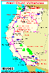
| Location Maps |


| Useful Links |
| For More Information |
 Medicine Lake and Lava Beds Menu
Return to:
[Visit A Volcano Menu] ...
[Climb A Volcano Menu] ...
[Medicine Lake and Lava Beds Menu]