|
|
||
 |
||
|
||||
|
Photo 1
A U.S. Coast Guard helicopter drops
a smoke marker on the surface of iceberg B-15A to
help determine wind direction for a landing. Mt. Erebus,
almost 13,000 feet high and the world's southernmost
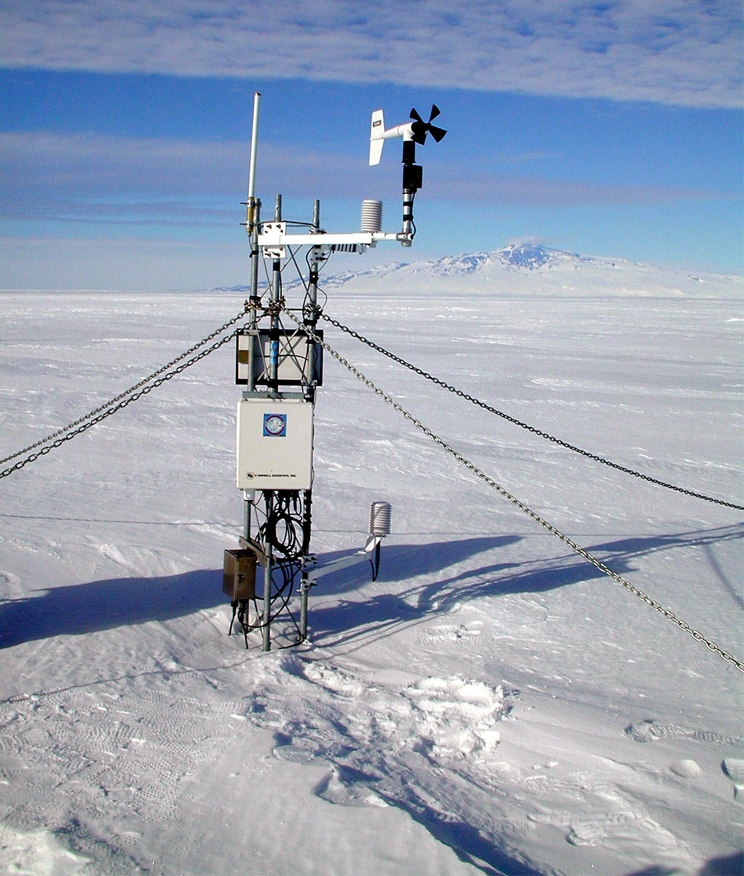
active volcano, is visible in the background. Photo 2
Douglas MacAyeal, a National Science
Foundation-funded researcher from the University of
Chicago, uploads new instructions to an automated
weather station on iceberg B-15A. MacAyeal landed
on the immense iceberg, perhaps for the last time,
in January to service weather stations he had placed
on the iceberg a year ago. Photo 3
Smaller icebergs of varying sizes float
in a zone between iceberg B-15A and a smaller, but
still extremely large berg designated C-16. The collision
zone between the two bergs is marked by narrow canyons
and wide, ice-choked bays as well as by areas such
as those in the center of the picture, where the edges
of the bergs have been forced up into peaks by collisions. Photo 4
U.S. Coast Guard pilot Sidonie Bosin
sketches out a proposed route for an informal photo
reconnaissance of iceberg B-15. Photo 5
One of the many fissures that are forming
within iceberg B-15A, which NSF-funded researcher
Douglas MacAyeal believes will cause the iceberg to
break up and drift northward. The cracks are perhaps
many hundreds of meters deep. Photo 6
One of the automated weather stations
on the iceberg. Photo 7
Return to Press Release NSF PR 02-12 - February 14, 2002
|
||||
|
|


|
|