Upper Midwest Environmental Sciences Center
|
|
| Home/ Overview/ Science Programs/ Data Library/ Products and Publications/States/ Rivers/Teachers and Students/ Links/ Contact/ Search |
ArcGIS Server |
|
||
|
|||
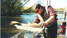
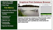
Long Term Resource Monitoring Program (LTRMP) |
|
|||
Query water quality, biology, and habitat data for the Upper Mississippi River LTRMP component database browsers
|
||||
|
||||

![]() U.S. Department of the Interior |
U.S. Geological Survey
U.S. Department of the Interior |
U.S. Geological Survey
URL: http://www.umesc.usgs.gov/data_library/tools/data_visualization_tools.html
Page Contact Information: Contacting the Upper Midwest Environmental Sciences Center
Page Last Modified:
April 15, 2009