 |
 | |
  | |
|
|
|
|
Big Bend National Park
Paved Roads
|
|
|
|
|
|
 |
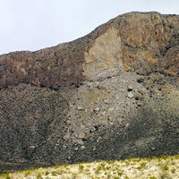 |
| NPS/Big Bend National Park | | This landslide is clearly visible from the road south of Persimmon Gap. |
 |
Persimmon Gap to Panther Junction
28 miles (45km)
This road connects the north entrance of the park to park headquarters at Panther Junction. From Persimmon Gap the road descends a long, gentle, gravel slope to Tornillo creek and the Tornillo Flat. The Rosillos Mountains rise to the west, and to the east the Dead Horse Mountains dominat the skyline. Highlights include the trailhead to Dog Canyon and Devil's Den, the Fossil Bone Exhibit area, and hoodoos located along the Tornillo Flat.
|
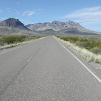 |
| Doug Duncan | | Nugent Mountain and Pummel Peak rise above the road. |
 |
Panther Junction to Rio Grande Village
21 miles (34km)
From Panther Junction you can head southeast toward the Rio Grande and Boquillas Canyon. In twenty miles, the road descends nearly two thousand feet. Along the way are the Dugout Wells picnic area and nature trail, the Hot Springs Historic District, and the Rio Grande Village developed area. Boquillas Canyon is the longest of the canyons of the Rio Grande within the park.
|
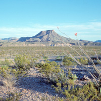 |
| NPS/Big Bend National Park | | Tule Mountain is a prominent landmark on the west side of the park. |
 |
Maverick Entrance Station to Panther Junction
23 miles (37km)
This drive in entirely confined to desert scenery with excellent views of the surrounding mountains. Numerous roadside exhibits explore the wildife that might be seen along the drive. Junctions for the Chisos Basin road and the Ross Maxwell Scenic Drive are located along this route.
|
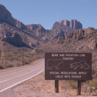 |
| Brian Dann | | The Chisos Basin Road climbs to nearly 6,000 feet! |
 |
Chisos Basin Road
6 miles (10km)
This road climbs five miles up Green Gulch and then drops into the Chisos Basin. The grade of the road is deceiving, being as much as 10% in places. This road was constructed in the 1930s by the Civilian Conservation Corps, and provides breathtaking views as you rise out of the desert and into the mountains.
Caution: The road to the Basin is not recommended for trailers longer than 20 feet and RVs over 24 feet because of sharp curves and steep grades.
|
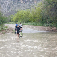 |
| Don Janes | | The road from Castolon to Santa Elena Canyon often floods after heavy rain. |
 |
Ross Maxwell Scenic Drive (to Castolon and Santa Elena Canyon)
30 miles (48km)
This road starts along the eastern edge of Burro Mesa, skirts the western flanks of the Chisos Mountains, and descends to the floodplain of the Rio Grande. Spectacular historic and geologic features are some of the highlights of the Ross Maxwell Scenic Drive.
The eight-mile road section from Castolon to Santa Elena Canyon is subject to flooding during late summer rains, and can be closed on occasion.
more...
|
|  |  |

|
 |
|
|
|
|
|
 |
|
Did You Know?
Pummel Peak (6,620'/2018m) is the easternmost of the peaks of the Chisos Mountain range in Big Bend National Park. Viewed from the southeast, the peak resembles a saddle pommel, hence the name (pummel is an alternate word for pommel).
|
|
|
|
Last Updated: August 24, 2006 at 12:40 EST |


