| 1600 |  |
Preparing to take air sample for carbon dioxide analysis. |
Mauna Loa, Hawaii 1982 February |
1601 |  |
Using an evacuated glass flask to collect air sample to be analyzed for carbon dioxide. This information will be added to the historic Scripps (Charles Keeling) long-term CO2 record. |
Mauna Loa, Hawaii 1982 February |
1602 |  |
Opening the valve into the wind of an evacuated glass flask while the observer holds his breath to keep from contaminating the sample. |
Mauna Loa, Hawaii 1982 February |
1603 |  |
Using the Dobson ozone spetrophotometer to measure the ozone content of the atmosphere by observing 2 ultraviolet wavelengths. |
Mauna Loa, Hawaii 1982 February |
1604 |  |
Recording solar radiation using a normal incidence pyrheliometer with a filter wheel. |
Mauna Loa, Hawaii 1982 February |
1605 |  |
Recording Dobson ozone data. |
Mauna Loa, Hawaii 1982 February |
1606 |  |
Demonstrating oxygen mask. After arriving at 11,000 feet altitude fresh from sea level, one often feels the need to perk up a little with oxygen before starting the day's work. |
Mauna Loa, Hawaii 1982 February |
1607 |  |
A condensation nuclei counter inside the observatory building. |
Mauna Loa, Hawaii 1982 February |
1608 |  |
Inside the observatory. |
Mauna Loa, Hawaii 1982 February |
1609 |  |
Inside the observatory calibrating the 4-wavelength nephelometer. |
Mauna Loa, Hawaii 1982 February |
1610 |  |
Updating the recording charts with time/date marks. |
Mauna Loa, Hawaii 1982 February |
1611 |  |
The Instrument Control and Data Acquisition System (ICDAS). |
Mauna Loa, Hawaii 1982 February |
1612 |  |
The Carbon Dioxide monitoring instrument panel. |
Mauna Loa, Hawaii 1982 February |
1613 |  |
The Mauna Kea astronomical observatories as seen from the air in winter. Mauna Loa is visible in the background. |
Mauna Kea, Hawaii 1982 February |
1614 |  |
The Mauna Kea astronomical observatories as seen from the air in winter. |
Mauna Kea, Hawaii 1982 February |
1615 |  |
The Mauna Kea astronomical observatories as seen from the air in winter. Mauna Loa is visible in the background. |
Mauna Kea, Hawaii 1982 February |
1616 |  |
A pahoehoe lava flow on the slope of Mauna Loa. |
Mauna Loa, Hawaii 1982 February |
1617 |  |
A lava formation at the entrance to a lava tube. |
Mauna Loa, Hawaii 1982 February |
1618 | 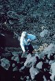 |
Vegetation making inroads into basalt field. |
Mauna Loa, Hawaii 1982 February |
1619 |  |
Cave-in section of roof of a lava tube. This is why walking on open lava fields can be quite dangerous. |
Mauna Loa, Hawaii 1982 February |
1620 |  |
Inside a lava tube. |
Mauna Loa, Hawaii 1982 February |
1621 |  |
Inside a lava tube. |
Mauna Loa, Hawaii 1982 February |
1622 |  |
Inside a lava tube. |
Mauna Loa, Hawaii 1982 February |
1623 |  |
Description not available. |
1982 February |
1624 |  |
Description not available. |
1982 February |
1625 |  |
Entrance to dome at Amundsen-Scott South Pole Station |
South Pole Station |
1626 |  |
The geodesic dome and skylab as seen from the old Clean Air Facility at South Pole Station. |
South Pole Station |
1627 |  |
The new Atmospheric Research Observatory (ARO) replaced the old Clean Air Facility. This was built for NOAA's Climate Monitoring and Diagnostics Laboratory in Boulder, Colorado. |
South Pole Station |
1628 |  |
Lieutenant Mark Boland taking air samples for Dr. Charles Keeling of the Scripps Institution of Oceanography. |
South Pole Station |
1629 |  |
Lieutenant Mark Boland making Ozone measurements with a Dobson spectrophotometer . Hair is a little out of regulation but no barbers at the South Pole. |
South Pole Station |
1630 |  |
Launching an ozonesonde. This balloon transported instrument measures a vertical profile of the ozone layer. |
South Pole Station |
1631 |  |
Launching an ozonesonde. This balloon transported instrument measures a vertical profile of the ozone layer. |
South Pole Station |
1632 |  |
Ozonesonde launch during the ozone hole episode of 1997. |
South Pole Station 1997 September |
1633 |  |
Sunset over the station in the austral fall of 1997. |
South Pole Station 1997 April |
1634 |  |
Aurora australis over South Pole Station in the 1997 austral winter. |
South Pole Station 1997 July |
1635 |  |
LIDAR measurement emanating from Atmospheric Research Observatory (ARO) Building . This instrument is used to measure stratospheric clouds. |
South Pole Station 1997 July |
1636 |  |
Lee Eason of the Seattle office observing angles with Eskimo helper |
Alaska Arctic Coast 1950 |
1637 |  |
A weasel making its way across a lagoon at Point Lay |
Alaska Arctic Coast 1950 |
1638 |  |
View of a weasel from the top of a pressure ridge out on the Beaufort Sea |
Alaska Arctic Coast 1950 |
1639 |  |
Looking down from the top of a pressure ridge. Man in picture provides sense of height of ridge. |
Alaska Arctic Coast 1950 |
1640 |  |
Cat train enroute from Pitt Point to Point Lay. Train is hauled by caterpillar tractors - thus term "cat train" |
Alaska Arctic Coast 1950 |
1641 |  |
Cat train enroute from Pitt Point to Point Lay. Train is hauled by caterpillar tractors - thus term "cat train" |
Alaska Arctic Coast 1950 |
1642 |  |
Leo Attungowruk and wife standing, Warren Neokok and wife sitting. The men helped with the survey work. At Point Lay Village. |
Alaska Arctic Coast 1950 |
1643 |  |
The camp at Pitt Point. |
Alaska Arctic Coast 1950 |
1644 |  |
Smoothing a landing strip on sea ice at Pitt Point. Long shadows and frozen sea indicate early in the spring. |
Alaska Arctic Coast 1950 |
1645 |  |
Commander Glenn Moore on the left, radioman Simonson, and Billy Neokok. |
Alaska Arctic Coast 1950 |
1646 |  |
A Norseman airplane delivering the mail. All mail was airmail in the Arctic field camps. |
Alaska Arctic Coast 1950 |
1647 |  |
Helping dig the ice cellar. Because of the permafrost, this served as a year- round refrigerator. |
Alaska Arctic Coast 1950 |
1648 |  |
Helping dig the ice cellar. Because of the permafrost, this served as a year- round refrigerator. |
Alaska Arctic Coast 1950 |
1649 |  |
Helping dig the ice cellar. Because of the permafrost, this served as a year- round refrigerator. |
Alaska Arctic Coast 1950 |

