Energy
The Monticello Field Office is experiencing an increase in its energy related work. This is largely due to price increases and market demand for oil, gas and uranium.
Reasonably Foreseeable Development (RFD) for Oil and Gas (260 KB)
Mineral Potential Report (MPR) (20.4 MB)
Maps 1 thru 7b (5592 KB)
Maps 8 thru 12a (3287 KB)
Maps 12b thru 17a (4294 KB)
Maps 17b thru 22 (4253 KB)
Maps 23 thru 24b (2305 KB)
LR 2000 Website: This website was designed for those who work in the oil and gas industry, title companies, utilities, state and local governments, who require access to BLM land and mineral records. Previously, the only way to access this information was to visit one of the BLM Information Access Centers. This website enables users to access the same information over the Internet. We have provided a tutorial to guide you through the reporting system. If you need assistance, please visit or call the
BLM Information Access Center nearest you.
Geocommunicator: The Land and Mineral Use Records website is an Internet mapping application within NILS' GeoCommunicator. It allows users to search, locate, and map the BLM's land and mineral use authorizations and mining claims on public lands throughout the United States. Land and mineral use authorizations include such things as oil and gas leases, rights-of-way, mineral leasing, coal leasing, unpatented mining claims, withdrawals, classifications, and land and mineral title.
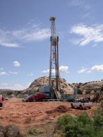
Drill Rig | 
Pump Jack | 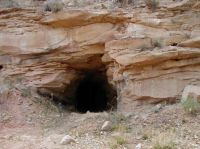
Uranium Mine
|