U.S. DEPARTMENT OF THE INTERIORBUREAU OF LAND MANAGEMENT
 
Print Page

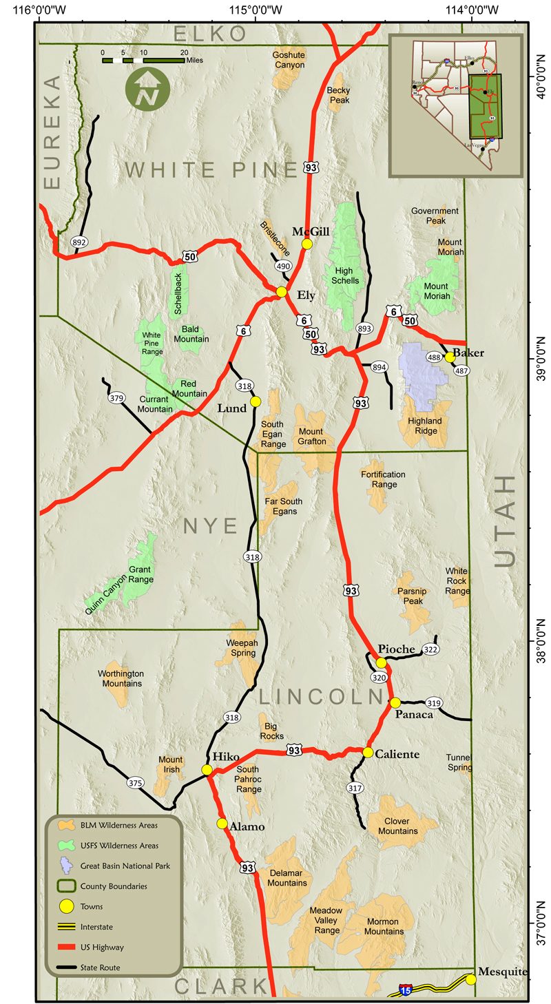
Ely District Wilderness Area Map

Click on any of the Wilderness Areas to display more information about the selected Wilderness Area.

Click here for a text list of all Wilderness Areas in the Ely District.


Go to Goshute Canyon Info Page Go to the Becky Peak Info Page Go to the Government Peak Info Page Go to the Mount Moriah Info Page Go to the Bristlecone Info Page Go to the South Egan Range Info Page Go to the Mount Grafton Info Page Go to the Fortification Range Info Page Go to the Highland Ridge Info Page Go to the Far South Egans Info Page Go to the White Rock Info Page Go to the Parsnip Peak Info Page Go to the Weepah Spring Info Page Go to the Worthington Mountains Info Page Go to the Big Rocks Info Page Go to the South Pahroc Range Info Page Go to the Delamar Mountains Info Page Go to the Clover Mountains Info Page Go to the Tunnel Spring Info Page Go to the Meadow Valley Range Info Page Go to the Mormon Mountains Info Page This is the Great Basin National Park. Please visit http://www.nps.gov/grba/ for more information. This is a wilderness area managed by the U.S. Forest Service. Please visit http://www.fs.fed.us for more information. This is a wilderness area managed by the U.S. Forest Service. Please visit http://www.fs.fed.us for more information. This is a wilderness area managed by the U.S. Forest Service. Please visit http://www.fs.fed.us for more information. Map showing the wilderness areas in the Ely Nevada District
 
Last updated: 01-06-2009