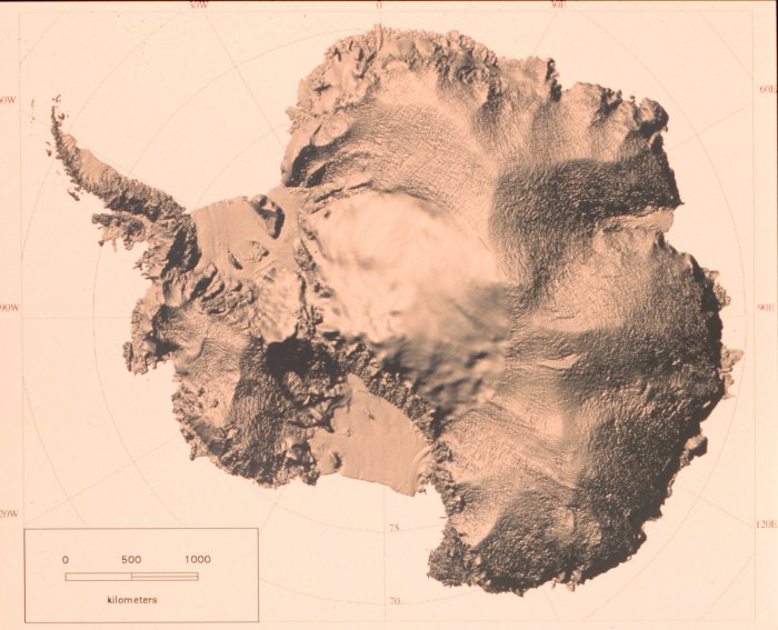
Shaded relief map of Antarctica developed from RADARSAT Synthetic Aperture Radar data. RADARSAT is a Canadian satellite.
Image ID: corp2359, NOAA At The Ends of the Earth Collection Photographer: Ken Jezek, Ohio State University • High Resolution Photo Available
Publication of the U.S. Department of Commerce, National Oceanic & Atmospheric Adminstration (NOAA), NOAA Central Library NOAA Privacy Policy | NOAA Disclaimer Last Updated: April 23, 2007

