| 450 |  |
Looking to the southwest - down Cook Inlet |
Cook Inlet, Alaska June, 1959 |
451 |  |
Hydrographic signal-building party on Fire Island - 9 miles southwest Anchorage Latitude 61 09 N; Longitude 150 12 W |
Fire Island, Cook Inlet, Alaska June, 1959 |
452 |  |
Tide staffs at Fire Island - note series of three staffs allowing leveling at all stages of 30 foot tide. Latitude 61 09 N; Longitude 150 12 W |
Fire Island, Cook Inlet, Alaska June, 1959 |
453 |  |
Resurrection Bay - in the vicinity of Turnagain Arm Latitude 61 06 N; Longitude 150 12 W |
Resurrection Bay, Alaska June, 1959 |
454 |  |
Resurrection Bay - in the vicinity of Turnagain Arm Latitude 61 06 N; Longitude 150 12 W |
Resurrection Bay, Alaska June, 1959 |
455 |  |
A glacier near Seward |
Seward, Alaska June, 1959 |
456 |  |
A view of Seward -- Latitude 60 06.5N; Longitude 149 26.5 W |
Seward, Alaska June, 1959 |
457 |  |
A view of Seward -- Latitude 60 06.5N; Longitude 149 26.5 W |
Seward, Alaska June, 1959 |
458 |  |
Reading the reversing thermometers after a Nansen cast Used to compute velocity of sound in seawater |
September, 1959 |
459 |  |
Army installations at Dutch Harbor |
Dutch Harbor, Unalaska Island, Alaska September, 1959 |
460 |  |
Lieutenant Commander Harley Nygren On the EXPLORER. |
Dutch Harbor, Unalaska Island, Alaska September, 1959 |
461 |  |
The EXPLORER at Dutch Harbor |
Dutch Harbor, Unalaska Island, Alaska September, 1959 |
462 |  |
The EXPLORER at Dutch Harbor |
Dutch Harbor, Unalaska Island, Alaska September, 1959 |
463 |  |
Lieutenant Commander Harley Nygren On the EXPLORER. |
Dutch Harbor, Unalaska Island, Alaska September, 1959 |
464 |  |
Lieutenant Commander Harley Nygren turning angles on the Alaska Peninsula It looks like a chilly September day. |
September, 1959 |
465 |  |
Pavlof Volcano on the Alaska Peninsula |
September, 1959 |
466 |  |
Passing through Unimak Pass and headed south on a brisk September day. On the EXPLORER. |
September, 1959 |
467 |  |
Shishaldin Volcano on the left - an Aleutian stratovolcano |
September, 1959 |
468 |  |
Shishaldin Volcano |
September, 1959 |
469 |  |
Gambell - the largest city on St. Lawrence Island |
Northern Bering Sea July, 1960 |
470 |  |
Dr. Richard Fleming on the bow of the Bureau of Commercial Fisheries Ship BROWN BEAR. |
Northern Bering Sea July, 1960 |
471 |  |
Hauling a dead walrus onto the Bureau of Commercial Fisheries Ship BROWN BEAR. |
Northern Bering Sea July, 1960 |
472 |  |
Lieutenant Commander Harley Nygren on the "hero platform." Taking a Nansen cast to determine water temperatures and density. |
Northern Bering Sea August, 1960 |
473 |  |
Cape Lisburne from the bridgewing of the Bureau of Commercial Fisheries Ship BROWN BEAR. |
Northern Bering Sea August, 1960 |
474 |  |
A Bering Sea sunset from the Bureau of Commercial Fisheries Ship BROWN BEAR. |
Northern Bering Sea August, 1960 |
475 |  |
The Bering Sea kicking up a little bit. On the Bureau of Commercial Fisheries Ship BROWN BEAR. |
Northern Bering Sea August, 1960 |
476 |  |
Cape York from at sea. |
Northern Bering Sea August, 1960 |
477 | 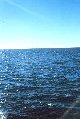 |
A drift buoy with radar reflector for studying surface currents. |
Northern Bering Sea August, 1960 |
478 | 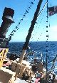 |
A rolly day on the BROWN BEAR. |
Northern Bering Sea August, 1960 |
479 |  |
The shore at Point Hope |
Northern Bering Sea August, 1960 |
480 |  |
Huskies and whale bones at Point Hope |
Northern Bering Sea August, 1960 |
481 | 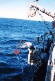 |
Deploying a Van Vehn grab sampler from the Bureau of Commercial Fisheries Ship BROWN BEAR. |
Northern Bering Sea August, 1960 |
482 |  |
The bow of the Bureau of Commercial Fisheries Ship BROWN BEAR. |
Northern Bering Sea August, 1960 |
483 |  |
The edge of the pack ice. |
Northern Bering Sea August, 1960 |
484 |  |
The edge of the pack ice. |
Northern Bering Sea August, 1960 |
485 |  |
The harbor at Montevideo |
Montevideo, Uruguay December 1961 |
486 |  |
The harbor at Port Stanley The beginning point of HMRS SHACKLETON Antarctic cruise |
Port Stanley, Falkland Islands December 1961 |
487 |  |
A view of the harbor The beginning point of HMRS SHACKLETON Antarctic cruise |
Port Stanley, Falkland Islands December 1961 |
488 |  |
Cruising in Lemaire Channel. 65 05 S Latitude 64 00 W Longitude. |
Antarctic Peninsula January 1962 |
489 |  |
Cruising in Lemaire Channel. 65 05 S Latitude 64 00 W Longitude. |
Antarctic Peninsula January 1962 |
490 |  |
Cruising in Lemaire Channel. 65 05 S Latitude 64 00 W Longitude. |
Antarctic Peninsula January 1962 |
491 |  |
Cruising in Lemaire Channel. 65 05 S Latitude 64 00 W Longitude. |
Antarctic Peninsula January 1962 |
492 |  |
Cruising in Lemaire Channel. 65 05 S Latitude 64 00 W Longitude. |
Antarctic Peninsula January 1962 |
493 |  |
The north shore of Peltier Channel. 64 52 S Latitude 63 32 W Longitude. |
Antarctic Peninsula January 1962 |
494 |  |
Ice in Peltier Channel - large white ice berg is 50 to 100 feet high. 64 52 S Latitude 63 32 W Longitude. |
Antarctic Peninsula January 1962 |
495 |  |
The first iceberg seen during the expedition |
Antarctic Peninsula January 1962 |
496 |  |
Passing an iceberg on a gray day |
Antarctic Peninsula January 1962 |
497 |  |
Mountain peak illuminated by midnight sun at Port Lockroy. 64 50 S Latitude 63 30 W Longitude. |
Antarctic Peninsula January 1962 |
498 |  |
The abandoned base at Port Lockroy. The SHACKLETON came here to remove equipment. 64 50 S Latitude 63 30 W Longitude. |
Antarctic Peninsula January 1962 |
499 | 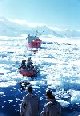 |
Boat from the SHACKLETON making its way through the ice at Port Lockroy. 64 50 S Latitude 63 30 W Longitude. |
Antarctic Peninsula January 1962 |