|

Press Release 06-038
Study of 2004 Tsunami Forces Rethinking of Giant Earthquake Theory

March 1, 2006
The Sumatra-Andaman earthquake of Dec. 26, 2004, was one of the worst natural disasters in history, largely because of the devastating tsunami that followed. Now, scientists have discovered that regions of the earth previously thought to be immune to such events may actually be at high risk of experiencing them.
Their findings, reported in this week's issue of the journal Nature, suggest researchers may need to revise their former ideas about where giant earthquakes are likely to occur.
"This earthquake didn't just break all the records, it also broke some of the rules," says scientist Kerry Sieh of Caltech, an author of the report.
"These exciting findings can help us learn how earthquakes such as this are generated, and therefore which areas around the world are at risk from these natural disasters," says Eva Zanzerkia, program director in the National Science Foundation's (NSF) division of earth sciences, which funded the research. "This discovery has global implications for understanding earthquake hazards."
Like all giant earthquakes, the 2004 event occurred along a giant earthquake fault where the Indian and Australian tectonic plates are diving beneath the margin of southeast Asia. Although the portion of the fault that ruptured lies several miles deep in the Earth's crust, the event caused considerable movement at the surface itself because it suddenly released so much long-accumulating elastic strain.
Sieh and his coworkers measured these surface motions by three different techniques. In one, they measured the shift in position of GPS stations whose locations had been accurately determined prior to the earthquake.
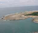
In the second method, they studied corals on island reefs: the top surfaces of these corals are normally at the water surface, so the presence of corals with tops above or below the water level indicated that the Earth's crust rose or fell by that amount during the earthquake.
Finally, the researchers compared satellite images of island lagoons and reefs taken before and after the earthquake: changes in the color of the seawater or reefs indicated a change in the water's depth and hence a rise or fall of the crust at that location.
On the basis of these measurements the researchers found that the surface rupture spanned a distance of up to 93 miles, and that along this huge contact area, the surfaces of the two plates slid against each other by up to 60 feet. Extrapolating to the deeper fault, they also found that the 2004 earthquake was caused by rupture of a 1,000-mile stretch of the megathrust--by far the longest of any recorded earthquake.
Indeed, the researchers say, the 2004 disaster was so much larger than any previously known rupture of this type that scientists may need to reassess many subduction zones that were previously thought to be at low risk.
For example, "the Ryukyu Islands between Taiwan and Japan are in an area where a large rupture would probably cause a tsunami that would kill a lot of people along the Chinese coast," says Sieh. "And in the Caribbean, it could well be an error to assume that the entire subduction zone from Trinidad to Barbados and Puerto Rico is not seismic."
The message of the 2004 earthquake to the world, says Sieh, "is that you shouldn't assume that a subduction zone, even though it's quiet, is incapable of generating great earthquakes."
-NSF-

Media Contacts
Cheryl Dybas, NSF (703) 292-7734 cdybas@nsf.gov
The National Science Foundation (NSF) is an independent federal agency that supports fundamental research and education across all fields of science and engineering. In fiscal year (FY) 2009, its budget is $9.5 billion, which includes $3.0 billion provided through the American Recovery and Reinvestment Act. NSF funds reach all 50 states through grants to over 1,900 universities and institutions. Each year, NSF receives about 44,400 competitive requests for funding, and makes over 11,500 new funding awards. NSF also awards over $400 million in professional and service contracts yearly.
 Get News Updates by Email Get News Updates by Email
Useful NSF Web Sites:
NSF Home Page: http://www.nsf.gov
NSF News: http://www.nsf.gov/news/
For the News Media: http://www.nsf.gov/news/newsroom.jsp
Science and Engineering Statistics: http://www.nsf.gov/statistics/
Awards Searches: http://www.nsf.gov/awardsearch/
|