Natural Hazards
Back to Natural Hazards Gateway Home
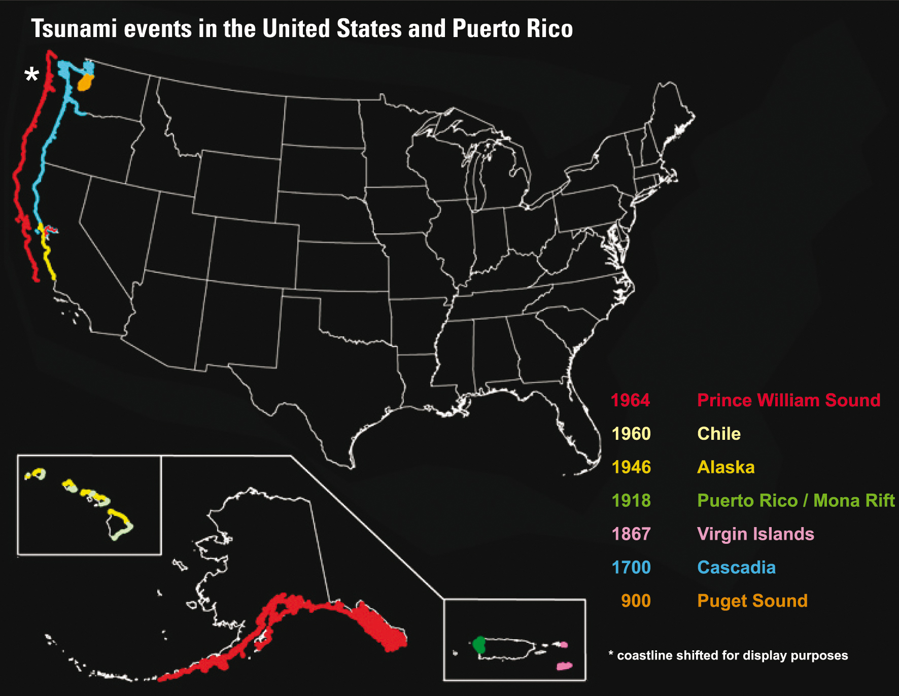
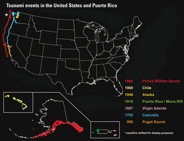
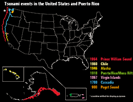 This map shows seven earthquake-generated tsunami events in the United States from the years 900 to 1964. The earthquakes that caused these tsunamis are: Prince William Sound, Alaska, 1964, magnitude 9.2; Chile, 1960, magnitude 9.5; Alaska, 1946, magnitude 7.3; Puerto Rico/Mona Rift, 1918, magnitude 7.3 to 7.5; Virgin Islands, 1867, magnitude undetermined; Cascadia, 1700, magnitude 9; and Puget Sound, 900, magnitude 7.5. Map not to scale. Sources: National Geophysical Data Center, NOAA, USGS (Hi-res | Low-res) Natural Hazards - TsunamisIn December 2004, when a tsunami killed more than 200,000 people in 11 countries around the Indian Ocean, the United States was reminded of its own tsunami risks. In fact, devastating tsunamis have struck North America before and are sure to strike again. Especially vulnerable are the five Pacific States—Hawaii, Alaska, Washington, Oregon, and California—and the U.S. Caribbean islands. In the wake of the Indian Ocean disaster, the United States is redoubling its efforts to assess the Nation’s tsunami hazards, provide tsunami education, and improve its system for tsunami warning. The U.S. Geological Survey (USGS) is helping to meet these needs, in partnership with the National Oceanic and Atmospheric Administration (NOAA) and with coastal States and counties.
|
|
USGS Tsunami Related News (USGS Newsroom)
|
Highlighted Tsunami Resources Select the
|

![]() U.S. Department of the Interior |
U.S. Geological Survey
U.S. Department of the Interior |
U.S. Geological Survey
URL: http://www.usgs.gov/hazards/tsunamis/default.asp
Page Contact Information: Ask USGS
Page Last Modified: Tuesday, July 08, 2008
