North Dakota Water Science Center

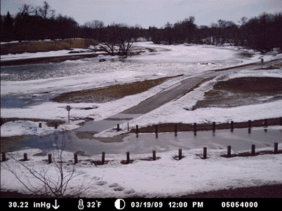 Time-lapse images from USGS camera at Midtown Dam, Fargo/Moorhead. Photos taken on Fargo side (Dike East) looking across to Moorhead side. Pressure in inches of mercury; temperature in degrees Fahrenheit. Downstream from USGS Fargo streamflow gage.
To use the above flood tracking chart for a particular property near the RED RIVER OF THE NORTH AT FARGO, ND gaging station:
Because the surface of flowing water is not flat and has a slope, the water-surface elevation near a threatened property might not be the same as the river stage at the gaging station.
Additional information for this gaging station
A History of Flooding in the Red River Basin Poster
10th Anniversary of the 1997 Red River Flood Poster
Back To Main Floodtracking Page

![]() U.S. Department of the Interior |
U.S. Geological Survey
U.S. Department of the Interior |
U.S. Geological Survey
URL: http://nd.water.usgs.gov/floodtracking/charts/05054000_09020104.html
Page Contact Information: Webmaster
Page Last Modified: Friday, 08-May-2009 13:35:06 EDT
Reston, VA [vaww51]
