Valley and Ridge, Piedmont, and Blue Ridge Aquifers
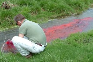
 Fluorescent tracer injection into a sinkhole in the Leetown area, WV. Tracer tests were conducted as part of intensive investigations of the hydrogeology, water quality,
and ground-water flow of the karst aquifer in the Hopewell Run Watershed, northern Shenandoah
Valley, near Leetown, West Virginia. (Photo by Mark Kozar)
The carbonate aquifers of the Appalachian Valley and Ridge Province are formed within a thick Paleozoic sequence of layered carbonate and siliciclastic rocks that were highly folded and faulted during Appalachian mountain building. Fluid flow thus has been through complex geologic structures, resulting in highly variable karst aquifer characteristics with a wide range of ground-water residence times, geochemical characteristics, and aquifer compartmentalization. Cave geometries likewise are variable, ranging from small, isolated caves of limited extent to some of the longest and deepest caves known in the United States.
The Great Valley aquifer is the primary carbonate aquifer in the Valley and
Ridge Province, formed within a sequence of Cambrian and Ordovician rocks over
10,000 feet (3,048 meters) thick. This aquifer is an important water resource for
numerous cities and towns along the Interstate 81 corridor from Tennessee to Pennsylvania.
The northern extent of the Great Valley in Virginia, West Virginia, and Maryland has been
particularly well studied, especially within the drainage basin of the Shenandoah River. Larger
springs typical of the Shenandoah Valley karst aquifer are 4th and 5th magnitude
(10-500 gal/min; 0.6 to 28 L/sec) artesian springs, most with relatively muted discharge variability.
Geologic structure strongly influences spring locations, discharge and geochemistry. Spring discharge
accounts for more than 85% of stream flow in the Shenandoah River basin. As a result, surface-water
quantity and quality is highly dependent on ground-water use and management. Circulation of ground water
through conduits exceeds depths of 2000 feet (610 meters) as evidenced by a small number of high-yield
deep wells. Most wells are finished less than 300 feet (100 meters) below land surface and may yield
between 1-150 gal/min (0.063-9.45 L/s). While the majority of springs have ambient water
temperatures, many mildly thermal springs have been identified.
The Shenandoah Valley karst hosts a number of unique endemic species. Of note is the Madison Cave Isopod (Antrolana lira), a crustacean of originally marine ancestry found only caves containing fresh ground water in the Shenandoah Valley region.
Photos of Karst Features
Karst produces distinctive topographic features that can be prominent and distinctive. There are photographs available of the following karst features in karst aquifers of the Valley and Ridge, Piedmont, and Blue Ridge province:
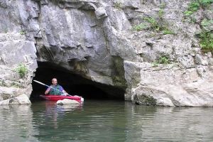
- Caves Along Creek
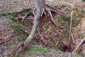
- Sinkholes
- Sinking Streams
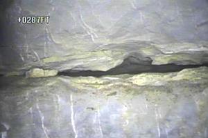
- Conduits
Featured Publications
- Kozar, M.D., McCoy, K.J., Weary, D.J., Field, M.S., Pierce, H.A., Schill, W.B., and Young, J.A. (2008) Hydrogeology and water quality of the Leetown area, West Virginia: USGS Open-File Report 2007-1358, 212 p.
- Kozar, M.D., Weary, D.J., Paybins, K.S., and Pierce, H.A. (2007) Hydrogeologic setting and ground-water flow in the Leetown Area, West Virginia: USGS Scientific Investigations Report 2007-5066, 70 p.
- Saad, D.A., and Hippe, D.J. (1990) Large springs in the Valley and Ridge physiographic province of Pennsylvania: USGS Open-File Report 90-164, 17 p.
Featured Studies and Datasets
Aquifer-scale studies and the datasets they produce are a key component to understanding how karst aquifers behave, and the quality of water within them.
- Assessment of the Northern Shenandoah Valley karst aquifer — Hydrogeologic assessment and simulation of ground-water flow.
Helpful Contacts
There are 5 USGS scientists you can contact for more information about this aquifer.
External Links
The following websites are additional sources of information about this aquifer:


