Cutting-Edge Tools Help Farmers Seek Out
Salt By Erin
Peabody
September 2, 2004
Getting too much salt in your fields? A network of federal
agencies is helping farmers in America's Southwest to answer that question.
Led partly by scientists with the
Agricultural Research Service, the
network provides resources to growers who wish to pinpoint salt-affected areas
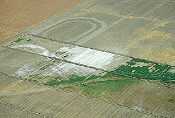
in their irrigated fields. High soil salinity can lead to stressed-out plants
and reduced yields.
The collaborative agency effort--known as the
Lower Colorado Region Salinity
Assessment Network (LCRSAN)--hopes to identify areas plagued by too much
salt and help alleviate the excess salinity. The effort is based on a
partnership between the ARS George E.
Brown Jr. Salinity Laboratory at Riverside, Calif., and the
U.S. Bureau of Reclamation (USBR).
Irrigation is a necessary lifeline for almost 1.25 million acres
of agricultural lands in Arizona, southern Nevada and southern California. But
as waters are channeled from the Colorado River and its tributaries and
conveyed to needy fields, they inevitably pick up salts such as sodium, calcium
and magnesium from the rocks of corridors and canyons along the way.
Through the network, USBR brings salt-detecting hardware and
software developed by ARS to salinity action agencies that, in turn, assist
their local farmers and growers.
Participating agencies include the
Coachella Valley Resource Conservation
District and the Imperial Irrigation
District, both in California; the Yuma Agricultural Center in Yuma,
Ariz.; and the U.S.
Bureau of Indian Affairs, along with the Natural Resources Conservation Service
office in Parker, Ariz.
Scott Lesch, the network's technical program coordinator based
at the ARS laboratory in Riverside, says that before LCRSAN, many growers were
ill-equipped to diagnose complex salinity problems. Lesch and ARS soil
scientist Dennis Corwin help train field personnel on using the new remote
sensing soil-assessment equipment.
Corwin says an ideal use of the ARS field equipment and software
is to test the feasibility of using recycled drainage waters for irrigation.
This could help conserve the region's valuable freshwater sources.
To
learn
more about the salinity network, see the September issue of Agricultural Research
magazine.
ARS is the U.S. Department of
Agriculture's chief scientific agency. |