USGS/CVO Logo, click to link to National USGS Website
USGS/Cascades Volcano Observatory, Vancouver, Washington

Three Sisters, Oregon
Photo Archives


Click button for information on using CVO text and images Use of CVO Material and Copyright Information

  • click on thumbnail for "user-friendly" medium-size image ...
  • medium-size images are around 100 K and best for web viewing ...
  • large-size images are 4-8 M, scanned images, no logo, 300 dpi, 8x10 to 9x12 size, and good for printing and publication ...

Image, click to enlarge
Sisters77_south_sister_lava_flows_09-77.jpg
Aerial view of the south flank of South Sister composite volcano showing numerous blocky lava flows erupted about 2,000 years ago. Early eruptions formed Rock Mesa (just above center, far left), a broad flat flow emplaced on nearly level ground. Subsequent eruptions formed a line of lava domes and flows that extend from Sparks Lake meadow (lower right) to Green Lakes (just above center, far right). Several small lava domes were also formed on the northeast flank, out of view. Cratered cone in lower left is Talapus Butte, a basaltic scoria cone.
USGS Photograph taken in September 1977 by C.Dan Miller.
[medium size] ... [large size] ... [TIF Format, 25 M]

Image, click to enlarge
Sisters81_aerial_three_sisters_broken_top_09-81.jpg
Aerial view of the Three Sisters volcanoes with Broken Top volcano lower right.
USGS Photograph taken in September 1981 by Willie Scott.
[medium size] ... [large size] ... [TIF Format, 25 M]
Image, click to enlarge
Sisters81_aerial_three_sisters_broken_top_09-81_bw.jpg
Aerial view of the Three Sisters volcanoes with Broken Top volcano lower right.
USGS Photograph taken in September 1981 by Willie Scott.
[medium size] ... [large size] ... [TIF Format, 17 M]

Image, click to enlarge
Sisters85_aerial_three_sisters_oregon_09-85.jpg
Aerial view, the Three Sisters volcanoes in Oregon, from the south looking north. Left to right -- South Sister, Middle Sister, and North Sister.
USGS Photograph taken in September 1985 by Lyn Topinka.
[medium size] ... [large size] ... [TIF Format, 18 M]
Image, click to enlarge
Sisters85_aerial_three_sisters_oregon_09-85_bw.jpg
Aerial view, the Three Sisters volcanoes in Oregon, from the south looking north. Left to right -- South Sister, Middle Sister, and North Sister. Black/white image made from color image.
USGS Photograph taken in September 1985 by Lyn Topinka.
[medium size] ... [large size] ... [TIF Format, 12 M]

Image, click to enlarge
Sisters85_south_sister_from_SE_09-85.jpg
South Sister as seen from the southeast.
USGS Photograph taken in September 1985 by Lyn Topinka.
[medium size] ... [large size] ... [TIF Format, 18 M]

Image, click to enlarge
Sisters85_USGS_scientist_EDM_lines_south_sister_09-85.jpg
USGS Scientist conducting Electronic Distance Measurement (EDM) lines, South Sister Volcano. EDM lines are conducted routinely to monitor these Cascades volcanoes for potential eruptive activity. By measuring the distance between two fixed points, these instruments can detect minor swelling of the volcanic edifice that often occurs prior to eruptions. The helicopter is measure air temperature along the line the EDM is reading.
USGS Photograph taken in September 1985 by Lyn Topinka.
[medium size] ... [large size] ... [TIF Format, 18 M]

Image, click to enlarge
Sisters95_south_sister_and_sparks_lake_1995.jpg
South Sister volcano, reflected in the waters of Sparks Lake, is the highest and youngest of the Three Sisters volcanoes in the central Oregon Cascades. The summit cone of South Sister has not erupted since the very latest Pleistocene, but the light-colored rocks above the meadow at the left are part of a group of lava flows on the flank that were extruded about 2000 years ago.
USGS Photograph taken in 1995 by David Wieprecht.
[medium size] ... [large size] ... [TIF Format, 18 M]

Image, click to enlarge
Sisters05_aerial_south_sister_from_west_01-14-05.jpg
Aerial view, the South Sister from the west.
USGS Photograph taken in January 14, 2005, by David Wieprecht.
[medium size] ... [large size]

Image, click to enlarge
Sisters05_aerial_middle_north_sisters_from_east_01-14-05.jpg
Aerial view, Middle Sister and North Sister, from the east.
USGS Photograph taken in January 14, 2005, by David Wieprecht.
[medium size] ... [large size]

Image, click to enlarge
Sisters05_south_sister_from_west_02-09-05.jpg
South Sister from the west.
USGS Photograph taken in February 9, 2005, by Gene Iwatsubo.
[medium size] ... [large size]

Image, click to enlarge
Sisters05_middle_north_south_sisters_02-09-05.jpg
Middle (left), North (just visible), and South Sister.
USGS Photograph taken in February 9, 2005, by Gene Iwatsubo.
[medium size] ... [large size]

Image, click to enlarge
Sisters05_north_middle_sisters_from_west_ssis_02-09-05.jpg
North Sister and Middle Sister, as seen from west of South Sister.
USGS Photograph taken in February 9, 2005, by Gene Iwatsubo.
[medium size] ... [large size]

Image, click to enlarge
Sisters05_aerial_three_sisters_from_west_02-09-05.jpg
Aerial, Three Sisters from the west.
USGS Photograph taken in February 9, 2005, by Gene Iwatsubo.
[medium size] ... [large size]

Image, click to enlarge
Sisters05_aerial_north_middle_sisters_from_west_02-09-05_bw.jpg
Aerial, North Sister and Middle Sister from the west. Converted to black/white from color original.
USGS Photograph taken in February 9, 2005, by Gene Iwatsubo.
[medium size] ... [large size]

Image, click to enlarge
Sisters05_aerial_south_sister_from_west_02-09-05_bw.jpg
Aerial, South Sister from the west. Converted to black/white from color original.
USGS Photograph taken in February 9, 2005, by Gene Iwatsubo.
[medium size] ... [large size]

Image, click to enlarge
Sisters05_aerial_three_sisters_bachelor_12-08-05.jpg
Aerial view, North, Middle, and, South Sister, Broken Top, and Mount Bachelor on the right, as seen from the southwest.
USGS Photograph taken on December 8, 2005, by Mike Doukas.
[medium size] ... [large size]

Image, click to enlarge
Sisters05_aerial_south_sister_broken_top_from_SW_12-10-05.jpg
Aerial view, South Sister and Broken Top, Oregon, as seen from the southwest.
USGS Photograph taken on December 10, 2005, by Mike Doukas.
[medium size] ... [large size]

Image, click to enlarge
Sisters06_south_sister_from_south_08-23-06.jpg
South Sister volcano as seen from the south.
USGS Photograph taken on August 23, 2006, by Carolyn Driedger.
[medium size] ... [large size]

Image, click to enlarge
Sisters06_middle_sister_south_sister_08-25-06.jpg
Middle Sister (left) and South Sister (right).
USGS Photograph taken on August 25, 2006, by Carolyn Driedger.
[medium size] ... [large size]

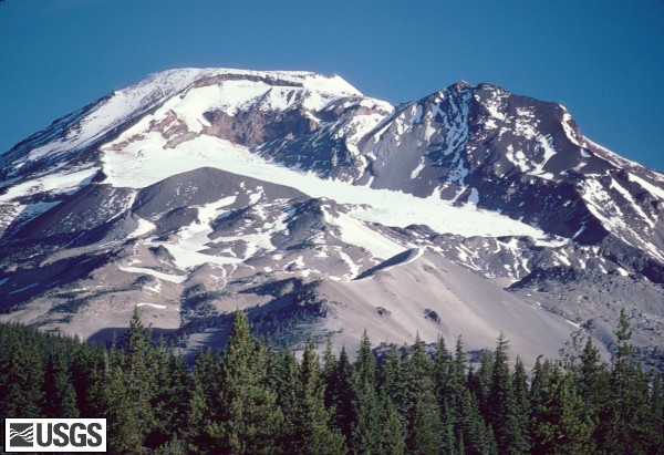
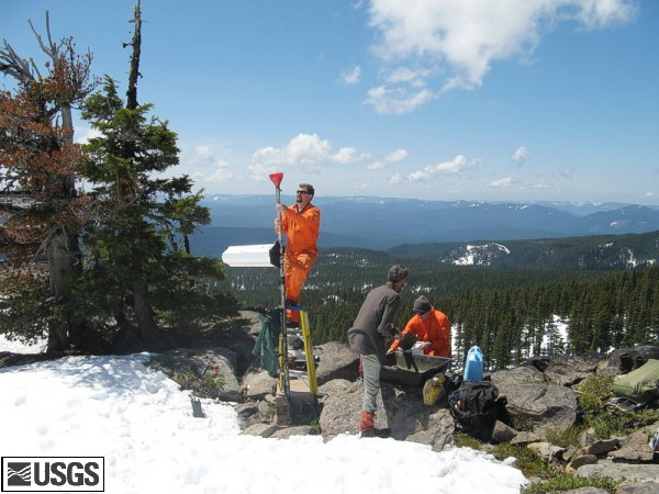
The Husband, Station Maintenance, May 10, 2007

Image, click to enlarge
Sisters07_TheHusband_seismic_station_maintenance_05-10-07.jpg
U.S. Geological Survey scientists repair seismic station, The Husband, Three Sisters, Oregon.
USGS Photograph taken on May 10, 2007, by Mike Lisowski.
[medium size] ... [large size, 150dpi, 4x5 inches]

Image, click to enlarge
Sisters07_TheHusband_gps_station_maintenance_05-10-07.jpg
U.S. Geological Survey scientists repair gps station, The Husband, Three Sisters, Oregon.
USGS Photograph taken on May 10, 2007, by Gene Iwatsubo.
[medium size] ... [large size, 300dpi, 8x10 inches]

Image, click to enlarge
Sisters07_TheHusband_gps_station__05-10-07.jpg
USGS GPS Station, The Husband, Three Sisters, Oregon.
USGS Photograph taken on May 10, 2007, by Dave Sherrod.
[medium size] ... [large size, 300dpi, 6x8 inches]

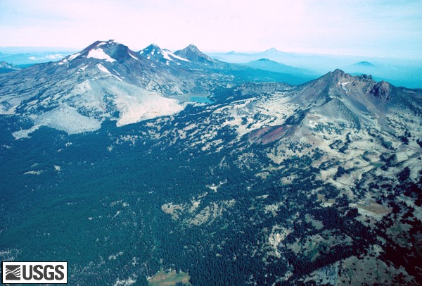
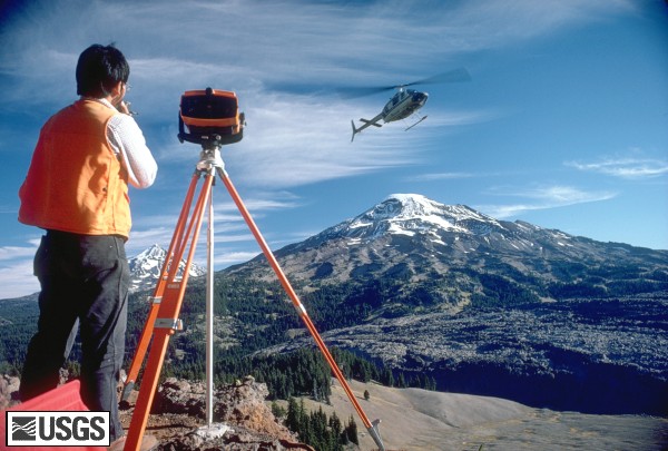
Leveling Images, August 2006

Image, click to enlarge
Sisters06_USGS_scientist_DanDzurisin_leveling_gun_08-24-06.jpg
U.S. Geological Survey scientist, Dan Dzurisin, using leveling gun at South Sister volcano, Oregon.
USGS Photograph taken on August 24, 2006, by Carolyn Driedger.
[medium size] ... [large size]

Click for more 
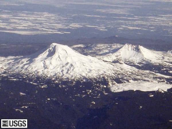
MORE 2006 Leveling Images

Annotated NASA Images

Annotated NASA Image, Three Sisters Vicinity, click to enlarge [Image,96K,InlineJPG]
Annotated NASA Image: Looking South at the Three Sisters, Mount Jefferson, and Mount Hood, Oregon, August 1985.
-- NASA Photo, courtesy NASA Earth From Space; Modified with text by USGS/CVO.

Annotated NASA Image, Three Sisters Vicinity, click to enlarge [Image,129K,InlineJPG]
Annotated NASA Image: Three Sisters, Broken Top, Mount Bachelor, and Diamond Peak, October 1994..
-- NASA Photo, courtesy NASA Earth From Space; Modified with text by USGS/CVO.


Return to:
[Three Sisters Menu] ...
[Oregon Photo Archives Menu] ...
[Cascade Range Photo Archives Menu] ...
[CVO Photo Archives Volcanoes Menu] ...
[NASA Images Menu] ...


CVO HomePage Volcanoes of the World Menu Mount St. Helens Menu Living With Volcanoes Menu Publications and Reports Menu Volcano Monitoring Menu Servers and Useful Sites Menu Volcano Hazards Menu Research and Projects Menu Educational Outreach Menu Hazards, Features, and Terminology Menu Maps and Graphics Menu CVO Photo Archives Menu Conversion Tables CVO Index - Search Our Site ButtonBar

Use of CVO Material and Copyright Information
URL for CVO HomePage is: <http://vulcan.wr.usgs.gov/home.html>
URL for this page is: <http://vulcan.wr.usgs.gov/Volcanoes/Sisters/images.html>
If you have questions or comments please contact: <GS-CVO-WEB@usgs.gov>
08/19/08, Lyn Topinka