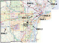
This site provides information about a research study that the U.S. Environmental Protection Agency conducted in Detroit, Michigan. The study, named the Detroit Exposure and Aerosol Research Study (DEARS), will help develop data that improves our understanding of human exposure to various air pollutants in our environment. The primary objective of DEARS was to compare air pollutant concentrations and their sources measured at central or community air-monitoring stations with those measured in various neighborhoods in the Detroit, Michigan area.
Below are some common questions associated with the study. These questions and answers are meant to be informative in nature and not an exhaustive explanation of the study or its findings. If you have further questions about the study that are not addressed on this site please contact us.
DEARS Select Preliminary Findings (Abstracts and Presentations) (updated November 2008)
DEARS Brochure (PDF, 2pp, 167 KB) - Print friendly document describing the Detroit Exposure and Aerosol Research Study.
DEARS Brochure En Español (PDF, 2 pp, 166 KB)
![[logo] US EPA](https://webarchive.library.unt.edu/eot2008/20090508061752im_/http://www.epa.gov/epafiles/images/logo_epaseal.gif)