
 Feeds & Data
M2.4 – Northern California
Thursday, April 23, 2009 at 16:04:35 UTC
Thursday, April 23, 2009 at 09:04:35 Local
Thursday, April 23, 2009 at 09:04:35 Local
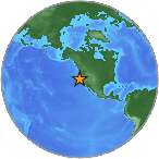
38.80°N 122.81°W
Depth: 4km


Printer Friendly Response Summary
| Location | MMI | Resp. | Distance | Latitude | Longitude |
|---|---|---|---|---|---|
| San Francisco, CA (94117) | 2 | 1 | 118 | 37.77°N | 122.44°W |
| Napa, CA (94558) | 2 | 2 | 57 | 38.50°N | 122.27°W |
| Vallejo, CA (94589) | 2 | 1 | 87 | 38.14°N | 122.25°W |
| Aptos, CA (95003) | 2 | 2 | 214 | 37.01°N | 121.88°W |
| Gilroy, CA (95020) | 2 | 3 | 226 | 37.02°N | 121.56°W |
| Morgan Hill, CA (95037) | 2 | 3 | 210 | 37.16°N | 121.61°W |
| Santa Cruz, CA (95060) | 2 | 1 | 201 | 37.06°N | 122.16°W |
| Santa Cruz, CA (95062) | 2 | 1 | 215 | 36.97°N | 121.99°W |
| Soquel, CA (95073) | 2 | 2 | 210 | 37.03°N | 121.95°W |
| Watsonville, CA (95076) | 2 | 4 | 226 | 36.94°N | 121.75°W |
| San Jose, CA (95139) | 2 | 2 | 197 | 37.22°N | 121.76°W |
| San Jose, CA (95141) | 2 | 1 | 203 | 37.17°N | 121.75°W |
- City mapJPG | PDF | PSMap of responses by city or ZIP code
- Intensity vs. DistanceJPG | PSPlot of Attenuation (fall-off) with distance for each intensity versus its distance from the epicenter
- Responses vs. TimeJPG | PSPlot of total number of responses since the event
- Product ListXMLList of available DYFI maps and data for this event
- Intensity SummaryTXT | XMLTable of intensities aggregated by city or ZIP code
