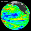
Follow this link to skip to the main content NASA Home Page JPL Home Page Caltech Home Page Sitemap Frequently Asked Questions Links Glossary NASA Home Page CNES Home Page AVISO Home Page JPL Home Page PO.DAAC Home Page
NASA - Jet Propulstion Laboratory + View the NASA Portal  
JPL Home JPL - Earth JPL - Solar System JPL - Stars and Galaxies JPL - Technology
Ocean Surface Topography from Space
sitemap, faq, links, glossary


OVERVIEW

SCIENCE

TECHNOLOGY

MISSIONS

NEWSROOM

EDUCATION

GALLERY


Link to tribute to Yves Menard

Link to 'Where are Jason-1 and TOPEX now?'

Join the Sealevel Mailing List
NASA's Newest Ocean Altimetry Tandem Mission
Link to Society Benefits
External Link to Sea Level Viewer
Link to Literature Database
Link to Monthly Time Series
Link to El Nino La Nina and PDO
Features
right side image
Latest Jason-1 Data Latest
El Niño/La Niña
Jason Data
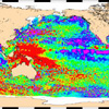
The latest image from NASA's Jason satellite is updated every two weeks. Check out the latest ocean conditions here!
Read the feature 'JPL's Bill Patzert and Josh Willis star in NASA 360°' JPL's Bill Patzert and Josh Willis star in NASA 360°
...talking about our ocean planet and sea level rise. Read more ...      

See the image 'A First Global View of Jason-1 and OSTM/Jason-2 Tandem Mission' A First Global View of Jason-1 and OSTM/Jason-2 Tandem Mission

View the image ...
SITE MAP FAQ LINKS GLOSSARY CONTACT & COPYRIGHT JPL PRIVACY STATEMENT
link to First Gov NASA logo