
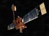
Mars Global Surveyor operated longer at Mars than any other spacecraft in history, and for more than four times as long as the prime mission originally planned. The spacecraft returned detailed information that has overhauled understanding about Mars.
Launched on November 7, 1996, the spacecraft entered orbit on September 12, 1997. After a year and a half trimming its orbit from a looping ellipse to a circular track around the planet, the spacecraft began its prime mapping mission in March 1999.
Among key science findings, the spacecraft took pictures of gullies and debris flow features that suggest there may be current sources of liquid water, similar to an aquifer, at or near the surface of the planet. It identified deposits of water-related minerals leading to selection of a Mars rover landing site. Magnetometer readings showed that the planet's magnetic field is not globally generated in the planet's core, but is localized in particular areas of the crust. Temperature data and closeup images of the Martian moon Phobos showed its surface is composed of powdery material at least 1 meter (3 feet) thick, caused by millions of years of meteoroid impacts. Data from the spacecraft's laser altimeter gave scientists their first 3-D views of Mars' north polar ice cap.
Mars Global Surveyor last communicated with Earth on Nov. 2, 2006. Within 11 hours, depleted batteries likely left the spacecraft unable to control its orientation. The battery failure appears to have been caused by a complex sequence of events involving the onboard computer memory and ground commands.
Arrival: September 12, 1997
Mass: 767 kilograms (1,691 pounds)
Science instruments: High-resolution camera, thermal emission spectrometer, laser altimeter, magnetometer/electron reflectometer, ultra-stable oscillator, radio relay system

Launch: November 7,1996
Report Reveals Likely Causes of Mars Spacecraft Loss (4/13/07)
Panel Will Study Mars Global Surveyor Events (1/10/07)
NASA's Mars Global Surveyor May be at Mission's End (11/21/06)
Orbiter's Long Life Helps Scientists Track Changes on Mars (9/20/05)
One Mars Orbiter Takes First Photos of Other Orbiters (5/19/05)
Mars Orbiter Sees Rover Tracks Among Thousands of New Images (9/27/04)
![]() + Mars Global Surveyor home page
+ Mars Global Surveyor home page
+ Mars Global Surveyor fact sheet (PDF file)