 |
 |
|

|


 |

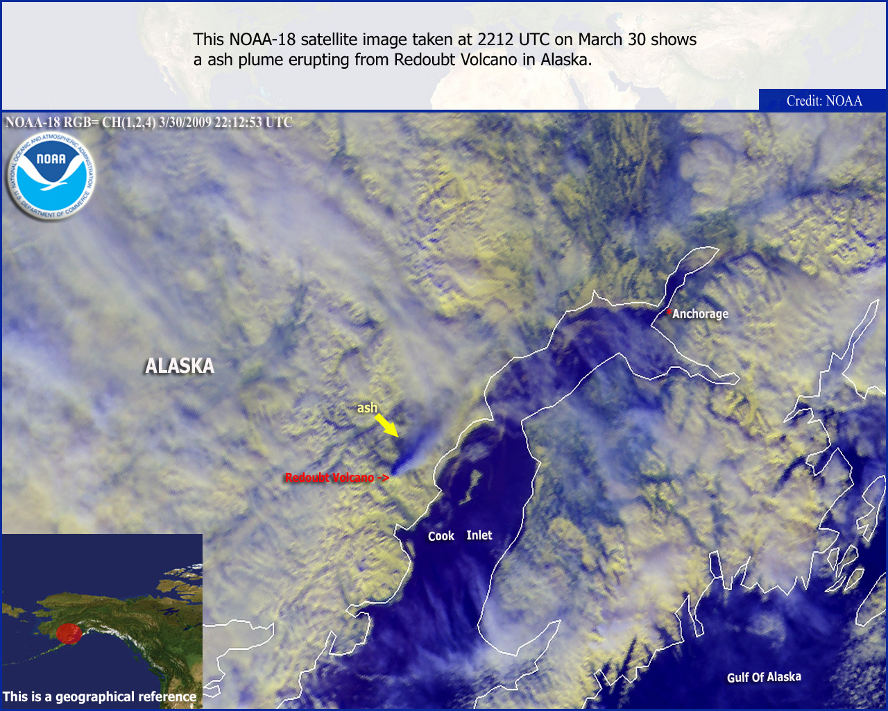
This page exists to provide members of the media with broadcast, print and web-quality imagery created by the OSEI team of particularly significant or newsworthy environmental events which are visible in satellite data available to us. The only annotation which will be provided on a consistent basis is the NOAA logo, satellite information header and political / coastal overlays. This page will soon include an archive of past OSEI Media Events and an area where you can submit feedback about the page. We occasionally create "Special Coverage" pages that follow particularly significant events and "Best of OSEI" pages which showcase some of our more striking imagery . Links to these and other features of our site are listed below.
The image below has been significantly reduced in size to accomodate the dimensions of this page. Clicking on the image will always display the image in the largest dimensions available and at full resolution. Links to every size of the image that was produced appear below the thumbnail.
To download these images, click the link for the image dimensions. Once the image has been displayed, right-click on the image and choose the "Save Image" or "Save Image As" options. |
|
|
Links
 OSEI Image of the Day »OSEI Home »Significant Event Imagery
»About US »FAQ »Disclaimer »Related Links »OSEI Map Viewer
|


|

|