USGS - science for a changing world

North Carolina Water Science Center

Home Information/Data Projects Publications Drought Floods About Us Contact
Lake Phelps

CURRENT CONDITIONS

Current streamflow conditions in North Carolina.

Current streamflow conditions map.
View a detailed map.

DATA CENTER

USGS IN YOUR STATE

USGS Water Science Centers are located in each state.

There is a USGS Water Science Center office in each State. Washington Oregon California Idaho Nevada Montana Wyoming Utah Colorado Arizona New Mexico North Dakota South Dakota Nebraska Kansas Oklahoma Texas Minnesota Iowa Missouri Arkansas Louisiana Wisconsin Illinois Mississippi Michigan Indiana Ohio Kentucky Tennessee Alabama Pennsylvania West Virginia Georgia Florida Caribbean Alaska Hawaii New York Vermont New Hampshire Maine Massachusetts South Carolina North Carolina Rhode Island Virginia Connecticut New Jersey Maryland-Delaware-D.C.

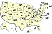
Hydrologic Information and Data for North Carolina

The U.S. Geological Survey currently operates over 250 data collection sites in North Carolina for acquiring information on surface water, groundwater, water quality, and precipitation. Many of the sites are equipped with satellite telemetry, which provides real-time data via GOES satellites and downlinks, which enables the posting of data to the Web for public use.

Surface-water information and data.

Surface Water

  • Real-time data
  • Reservoir links
  • and more...
USGS's National Water Information System.

NWISWeb

Real-time and historical water data from USGS's National Water Information System (NWISWeb).

Groundwater information and data.

Groundwater

  • Real-time data
  • Groundwater Networks
  • and more...
Interactive real-time data map.

Interactive Real-Time Data Retrieval Map

Geographic interface to water data from about 400 USGS sites in North Carolina.

Water-quality information and data.

Water Quality

  • Real-time monitoring
  • Sample Data
  • Field Methods
  • and more...
Water-montioring sites in North Carolina.

Site Data

Direct access to real-time and historical water data by site number.

Water Use information and data.

Precipitation and meteorological data

  • Precipitation data
  • Real-time weather
  • and more...
USGS WaterWatch system.

WaterWatch

Maps, graphs, and tables describing streamflow conditions for the United States.

GIS Data.

Geospatial Resources (GIS)

  • GIS data
  • Imagery
  • Standards
  • and more...
Hazards information and data.

Hazards

  • Floods and Droughts
  • Hurricanes
  • Landslides
  • and more...
Water Use information and data.

Water Use

North Carolina's water use


USGS Home Water Resources Biology Geography Geology Geospatial

Accessibility FOIA Privacy Policies and Notices

Take Pride in America logo USA.gov logo U.S. Department of the Interior | U.S. Geological Survey
URL: http://nc.water.usgs.gov/infodata/index.html
Page Contact Information: North Carolina Web Development Team
Page Last Modified: Thursday, 26-Mar-2009 15:54:48 EDT