Biology - Invasive Species Program
|
USGS: Biology
|
||||||||||
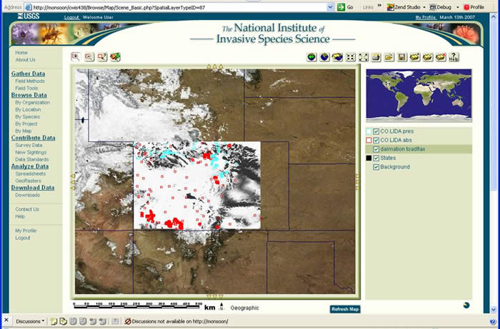
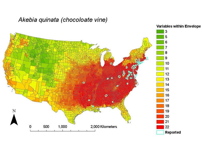
Documenting, Forecasting and Mapping Invasive Species for Early Detection / Rapid Assessment ForecastingHarmful invasive species cost the country an estimated $120 Billion/year, making them a top economic and environmental threat of the 21st century, and a serious threat to human health (e.g., plague, West Nile Virus, Asian Bird Flu). Our objectives are to: (1) make better use of existing data, identify habitats vulnerable to invasion, identify the highest priority invasive species, and better coordinate all aspects of invasive species science, such as prevention, early detection and rapid assessment, monitoring and research, and outreach; and (2) use high-performance modeling, space-based observations, and web-based forecasting and decision support tools as essential elements of the nation's emerging assault on invasive species. The ultimate goal is to establish an effective National Institute of Invasive Species Science (NIISS) -- a USGS-led consortium of governmental and non-governmental partners whose aim is to provide reliable information and advanced decision support tools for documenting, understanding, predicting, assessing, and addressing the threat of invasive species in the United States. The Institute was created in response to high priority needs for invasive species research and management identified by USGS and Department of Interior clients, such as the National Park Service, US Fish and Wildlife Refuge System, Bureau of Land Management, Bureau of Reclamation, tribes, other land management agencies, state and local governments, Tribes, and the public. We completed a national synthesis that shows, contrary to past theory, that areas high in native species richness are have also been heavily invaded by non-native plants, birds, and fishes. Many patterns of invasion are highly predictable based on environmental attributes. We are creating a web-based data management, mapping, and modeling system to assist agencies, state and local governments, Tribes, and the public in battling harmful invasive species (www.NIISS.org). The next steps are to: (1) create an "Invasive Species Solution Center" with advanced modeling capabilities and decision support systems for general use; (2) input more data on more species into the system; (3) greatly enhance on-line spatial modeling techniques; and (4) make many of these tools broadly available to the public.
|
|
|||||||||
| USGS Home :: Geology :: Geography :: Water | ||||||||||