 |

|
|
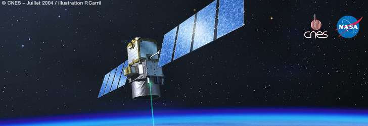
The Cloud-Aerosol Lidar and Infrared Pathfinder Satellite Observation (CALIPSO)
CALIPSO, a joint mission between NASA and the French space agency, CNES, provides new insight into the role that clouds and atmospheric aerosols (airborne particles) play in regulating Earth's weather, climate, and air quality.
Hurricane Season 2009: Hurricane Bill (Atlantic)
NASA's Cloud-Aerosol Lidar and Infrared Pathfinder Satellite (CALIPSO) captured a vertical profile of the upper portion of the hurricane's clouds structure. In an image taken on August 19 2009, the eye of the storm was evident in the image taken as it appeared as a break in the clouds.

CALIPSO Sees Through the Haze
New research, using measurements from CALIPSO, shows that the warming effect of aerosols increases with the amount of cloud cover below the aerosols, according to a paper published recently in Nature Geoscience by a team of scientists from the United States and India.

CALIPSO Makes Successful Switch to Backup Laser, Keeping Important Data Stream Alive
The CALIPSO satellite is helping scientists solve the puzzle of how clouds and aerosols affect Earth's climate.

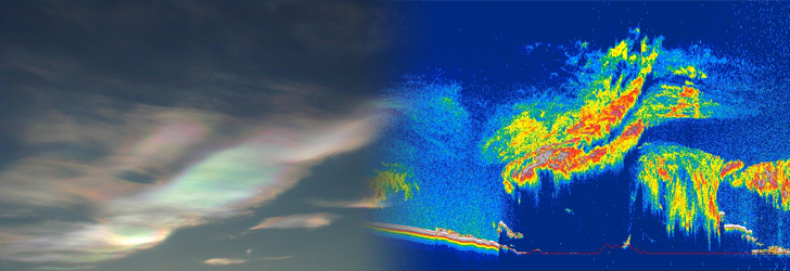
CALIPSO Finds Smoke at High Altitudes Down Under
As smoke plumes from powerful bushfires clouded the Australian skies in early February, satellites orbiting the Earth captured the rapid dispersal of smoke in real-time. CALIPSO saw the occurrence from a different perspective and uncovered a rare phenomenon.

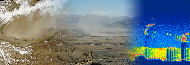
Summer dust aerosols detected from CALIPSO over the Tibetan Plateau
Summertime dust aerosol plumes over northwestern Tibet detected by the CALIPSO satellite reveals that dust storms occur more frequently than previously found because few surface sites were available due to high elevation and harsh climate.
CALIPSO's Images Offer New Dimension to Air Quality and Climate Research
CALIPSO seeks to reveal the secrets of clouds and aerosols, enabling scientists to study how they form, evolve and interact and how they affect our air quality, weather and climate.
Understanding the Relationship between Polar Stratospheric Clouds and Arctic Ozone Loss
Polar stratospheric clouds (PSCs) are clouds in the winter polar stratosphere. Research has indicated that PSCs contribute to the formation of ozone holes. CALIPSO offers a new opportunity to characterize PSCs on spatial and temporal scales previously thought impossible.
Our Changing Planet: CALIPSO contributes to the United States Climate Change Science Program (CCSP)
CALIPSO's innovative measurement capabilities are helping to better understand how aerosols modify Earth's climate, how they affect cloud lifetimes and precipitation, and how they are lofted into the free troposphere, transported long distances, and affect air quality.

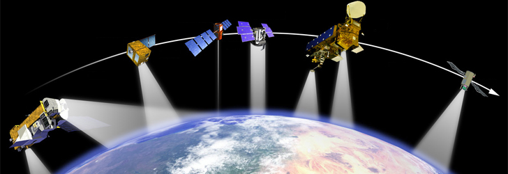
CloudSat and CALIPSO: Revealing the Secrets of Clouds and Aerosols
Together, the CloudSat and CALIPSO missions will help precisely measure key elements of the water cycle and pursue knowledge about clouds and aerosols, short-term air quality and help answer important questions about the nature of our planet.

Expedited CALIPSO browse images are now available in Google Earth KMZ format
The CALIPSO team is making some of its browse imagery data available in the Google Earth KMZ format to facilitate scientific data visualization, exploration and research.

The A-Train Express
In NASA CONNECT™: The “A” Train Express, students will learn how weather affects everyone's daily lives and see how national and international scientists are using satellite technology to help improve weather forecasting and our understanding of aerosols and clouds.
|
 |
| RECENT NEWS |
02-JULY-2009:
In March 2009, the CALIPSO Team switched successfully from Laser 2 to Laser 1 as planned prior to launch. Since then, the performance of Laser 1 has been monitored, extensively analyzed and the results compared to Laser 2 performance.
A new version of the Lidar Level 1 data set is being released. The maturity level definition of this release has been set to "Validated Stage 1." This Version 3.00 release includes updated algorithms.
At this time, browse images between March 12, 2009 to June 10, 2009 are posted on this web site and the data are available from the Atmospheric Science Data Center.
28-APRIL-2009:
CALIPSO and CloudSat celebrate 3 years on-orbit
Three years ago on April 28, 2006, CALIPSO and CloudSat launched with the hope of collecting important scientific data that would contribute to a better understanding of air quality, weather and climate.
To date, CALIPSO has acquired more than 1.612 billion lidar profiles and the spacecraft/payload remain healthy with the prospect of 3 or more years of continue measurements to come.
CALIPSO and the other missions of the A-Train continue to do well and together they provide a rich, valuable data record that will help scientists answer significant questions about climatic processes and help improve ever-important climate prediction models.
|
20-MARCH-2009:
The CALIPSO Laser Switch has been completed and normal operations resumed on March 20, 2009. Release of standard data products from the backup laser are expected to resume in early May after a period to review the instrument's calibration.
|
|
|
|
|
|
INTRODUCTION
The Cloud-Aerosol Lidar and Infrared Pathfinder Satellite Observation (CALIPSO) satellite provides new insight into the role that clouds and atmospheric aerosols (airborne particles) play in regulating Earth's weather, climate, and air quality.
CALIPSO combines an active lidar instrument with passive infrared and visible imagers to probe the vertical structure and properties of thin clouds and aerosols over the globe. CALIPSO was launched on April 28, 2006 with the cloud profiling radar system on the CloudSat satellite.
CALIPSO and CloudSat are highly complementary and together provide new, never-before-seen 3-D perspectives of how clouds and aerosols form, evolve, and affect weather and climate. CALIPSO and CloudSat fly in formation with three other satellites in the A-train constellation to enable an even greater understanding of our climate system from the broad array of sensors on these other spacecraft.
CALIPSO is a joint U.S. (NASA) and French (Centre National d'Etudes Spatiales/CNES) satellite mission with an expected 3 year lifetime.
» Read more …
|
|
|
 |
Last Updated: August 24, 2009
Curator:
NASA Official:
|
|
|
|
|
|
|
|
|
 |