National Water-Quality Assessment (NAWQA) Program
Go to:
Citation--
Ryker, S.J., Nov. 2001, Mapping arsenic in groundwater: Geotimes v.46 no.11, p.34-36.
Alternate formats--
PDF in red/yellow/green (0.4 Mb)
Original map--
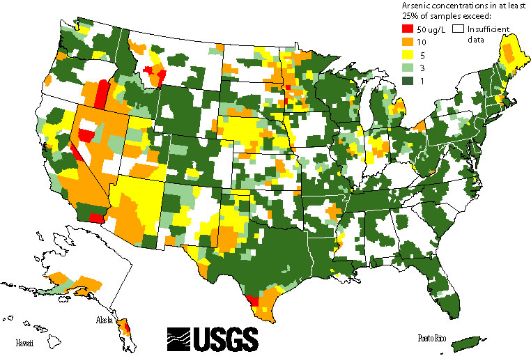
The May 2000 county map was based on 18,850 ground-water samples, and showed arsenic concentrations found in at least 10% of samples per county. The map below is based on 31,350 ground-water samples, and shows arsenic concentrations found in at least 25% of samples per county.

![]() U.S. Department of the Interior |
U.S. Geological Survey
U.S. Department of the Interior |
U.S. Geological Survey
URL: http://water.usgs.gov/nawqa/trace/pubs/geo_v46n11/fig2.html
Page Contact Information: gs-w_nawqa_info@usgs.gov
Page Last Modified: Tuesday, 14-Oct-2008 14:57:46 EDT
