Water Resources of Maryland, Delaware, and the District of Columbia
![]()

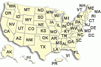
Click anywhere on the map above to explore
USGS real-time streamflow sites in Maryland.
Welcome to the homepage of the Maryland-Delaware-District of Columbia Water Science Center of the United States Geological Survey (USGS).
Here, you can find information about our projects, publications, and other activities. We also maintain and monitor a network of real-time data-collecting sites throughout the region.
Read our Science Strategy to learn more about our goals and operations.

The USGS participates in the Maryland Water Monitoring Council, which consists of numerous local, State, and Federal agencies in Maryland, as well as universities, consulting complanies, and other organizations. The main goal of the Council is to foster cooperation among groups involved in water-monitoring activities in Maryland. The Council's annual conference is scheduled for December 4; information about the annual meeting can be found at http://mddnr.chesapeakebay.net/mwmc/.
Seminars and Events at the USGS!
Visit this page for news and information about seminars and other events being held at the MD-DE-DC Water Science Center
Monthly Water Conditions Summary

April 2009 : USGS Maryland-Delaware-DC Monthly Water Conditions Summary
Water Data

To view monthly ground water levels, streamflow statistics, and other information about the water resources of the area, visit our Water Data page.
StreamStats

StreamStats is map-enabled Web application that can provide users with streamflow statistics, basin characteristics, and other information for USGS data-collection stations and for ungaged sites. Users can select data-collection station locations shown on a map interface and obtain previously published information for the stations. Users can also select any location along a stream and obtain the drainage-basin boundary, basin characteristics, and estimated streamflow statistics for the location.
USGS Hot Topics
2007 Annual Data Report
The 2007 Annual Data Report is now available.
Instantaneous Data Archive
Access historical instantaneous streamflow data with the new USGS online database: Instantaneous Data Archive (IDA)
Real-Time Water Quality in MD-DE-DC
 About twenty stations in MD-DE-DC measure one or more water-quality constituents (temperature, dissolved oxygen, turbidity, specific conductance, and pH) in real-time, and these data can be viewed on the web. Additionally, three stations go a step further by reporting real-time computed concentrations of total nitrogen, phosphorus, and suspended sediment on this website; data are computed using regression models, and represent an innovative way to monitor the water quality of Maryland streams.
New Publications Available Online
![]() FS 2009-3009
FS 2009-3009
David Bolton, James Gerhart, and Saeid Kasraei, Sustainability of Water Resources in the Fractured-Rock Area of Maryland, 2p.
![]() FS 2007-3085
FS 2007-3085
Michael J. Brayton, Judith M. Denver, Gregory C. Delzer, and Pixie A. Hamilton, Organic Compounds in Potomac River Water Used for Public Supply near Washington, D.C., 2003–05, 6p.
![]() SIR 2008-5190
SIR 2008-5190
Scott W. Ator, Natural and Human Influences on Water Quality in a Shallow Regional Unconsolidated Aquifer, Northern Atlantic Coastal Plain, 32p.
![]() SIR 2008-5144
SIR 2008-5144
Cheryl A. Dieter and William B. Fleck, Simulation of Ground-Water Flow and Optimization of Withdrawals from Aquifers at the Naval Air Station Patuxent River, St. Mary's County, Maryland, 48p.
![]() FS 2008-3068
FS 2008-3068
Scott W. Ator and Betzaida Reyes, Pesticides in Ground Water of Central and Western Maryland, 6p.
New Online Posters Available
 Streamflow and Water-Quality Monitoring in Montgomery County, Maryland
By Brenda Majedi, Cherie Miller, Anthony Modugno, Bill Davies
For more posters, visit our Online Poster Index.