
 Feeds & Data
Magnitude 4.5 - NEAR THE COAST OF NORTHERN PERU
2009 May 05 16:11:02 UTC
Earthquake Details
| Magnitude | 4.5 |
|---|---|
| Date-Time |
|
| Location | 3.241°S, 81.699°W |
| Depth | 27.7 km (17.2 miles) set by location program |
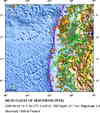
| Region | NEAR THE COAST OF NORTHERN PERU |
| Distances | 145 km (90 miles) WNW of Tumbes, Peru 190 km (120 miles) W of Machala, Ecuador 230 km (145 miles) WSW of Guayaquil, Ecuador 1110 km (690 miles) NNW of LIMA, Peru |
| Location Uncertainty | horizontal +/- 15.4 km (9.6 miles); depth fixed by location program |
| Parameters | NST= 24, Nph= 24, Dmin=527.7 km, Rmss=1.1 sec, Gp=166°, M-type=body wave magnitude (Mb), Version=Q |
| Source |
|
| Event ID | us2009ggbf |
- This event has been reviewed by a seismologist.
- Did you feel it? Report shaking and damage at your location. You can also view a map displaying accumulated data from your report and others.


Earthquake Maps


Scientific & Technical Information
 Historic Moment Tensor Solutions
- Preliminary Earthquake Report
- U.S. Geological Survey, National Earthquake Information Center:
World Data Center for Seismology, Denver
