
 Feeds & Data
Magnitude 4.8 - KERMADEC ISLANDS, NEW ZEALAND
2009 May 03 14:01:21 UTC
Earthquake Details
| Magnitude | 4.8 |
|---|---|
| Date-Time |
|
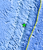
| Location | 30.113°S, 178.541°W |
| Depth | 126.4 km (78.5 miles) |
| Region | KERMADEC ISLANDS, NEW ZEALAND |
| Distances | 115 km (70 miles) SW of Raoul Island, Kermadec Islands 150 km (95 miles) NNE of L'Esperance Rock, Kermadec Islands 975 km (600 miles) NE of Auckland, New Zealand 1380 km (860 miles) NNE of WELLINGTON, New Zealand |
| Location Uncertainty | horizontal +/- 13.1 km (8.1 miles); depth +/- 9.4 km (5.8 miles) |
| Parameters | NST= 49, Nph= 49, Dmin=113 km, Rmss=1.13 sec, Gp= 72°, M-type=body wave magnitude (Mb), Version=Q |
| Source |
|
| Event ID | us2009geau |
- This event has been reviewed by a seismologist.
- Did you feel it? Report shaking and damage at your location. You can also view a map displaying accumulated data from your report and others.
Earthquake Maps


Scientific & Technical Information
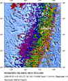
 Historic Moment Tensor Solutions
- Preliminary Earthquake Report
- U.S. Geological Survey, National Earthquake Information Center:
World Data Center for Seismology, Denver
