
 Feeds & Data
Magnitude 4.5 - STATE OF YAP, FED. STATES OF MICRONESIA
2009 May 03 10:25:03 UTC
Earthquake Details
| Magnitude | 4.5 |
|---|---|
| Date-Time |
|
| Location | 11.069°N, 140.507°E |
| Depth | 52.9 km (32.9 miles) |
| Region | STATE OF YAP, FED. STATES OF MICRONESIA |
| Distances | 310 km (195 miles) NE of Yap, Micronesia 530 km (330 miles) WSW of HAGATNA, Guam 615 km (380 miles) WSW of Rota, Northern Mariana Islands 1995 km (1230 miles) WNW of PALIKIR, Pohnpei, Micronesia |
| Location Uncertainty | horizontal +/- 10 km (6.2 miles); depth +/- 17.3 km (10.7 miles) |
| Parameters | NST= 31, Nph= 31, Dmin=550.3 km, Rmss=0.75 sec, Gp= 94°, M-type=body wave magnitude (Mb), Version=Q |
| Source |
|
| Event ID | us2009geaq |
- This event has been reviewed by a seismologist.
- Did you feel it? Report shaking and damage at your location. You can also view a map displaying accumulated data from your report and others.
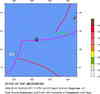
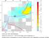
Earthquake Maps


Scientific & Technical Information
 Historic Moment Tensor Solutions
- Preliminary Earthquake Report
- U.S. Geological Survey, National Earthquake Information Center:
World Data Center for Seismology, Denver
