
 Feeds & Data
Magnitude 3.4 - CENTRAL CALIFORNIA
2009 May 02 23:36:49 UTC
Earthquake Details
| Magnitude | 3.4 |
|---|---|
| Date-Time |
|
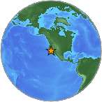
| Location | 36.698°N, 117.683°W |
| Depth | 4.5 km (2.8 miles) |
| Region | CENTRAL CALIFORNIA |
| Distances |
|
| Location Uncertainty | horizontal +/- 0.6 km (0.4 miles); depth +/- 3.7 km (2.3 miles) |
| Parameters | Nph= 27, Dmin=20 km, Rmss=0.3 sec, Gp= 68°, M-type=local magnitude (ML), Version=C |
| Source | |
| Event ID | ci10404265 |
- This event has been reviewed by a seismologist.
- Did you feel it? Report shaking and damage at your location. You can also view a map displaying accumulated data from your report and others.
Earthquake Maps
Earthquake Location
Location Maps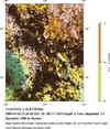
Historical Seismicity
Seismic Hazard Map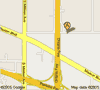
Google Map
Google Earth KML
(Requires Google Earth)- Did you feel it? Report shaking and damage at your location. You can also view a map displaying accumulated data from your report and others.

