
 Earthquake Topics — Modeling
| Link | |||
|---|---|---|---|
| Organization | Topics | Content Types | Level |
1906 San Francisco Earthquake and Fire Visualizations — This collection presents links to images, films, panoramas and animations about the earthquake and fire. | |||
| Carleton College/NAGT materials | San Andreas Fault Photos, Earthquake Modeling Lessons online Damage from Earthquakes Tsunamis Societal Effects Historic Earthquakes Geology Engineering, Earthquake Effects, Earthquake Education resources |  Lesson Plans Lesson Plans Graphics Graphics | General Audience College High School |
Constructing Earthquake-Proof Buildings — construct a model building and test it | |||
| DiscoverySchool.com | Engineering, Earthquake Modeling | Lesson Plans | Middle School |
High Quality Earthquake Animations — Simulations of earthquake ruptures that were run on the supercomputers at Caltech's Center for Advanced Computing Research | |||
| USGS | Effects, Earthquake Faults - SS, DS, Thrust, etc. Modeling Seismic waves Shaking | Graphics | High School General Audience College |
Plate Tectonic Movement Visualizations — Visualizations and supporting material that can be used effectively to teach students about plate tectonic movements. Visualizations include simple animations, GIS-based animated maps, paleogeographic maps and globes, as well as numerous illustrations and photos. | |||
| Carleton College/NAGT materials | Plate tectonics GIS Geology Education resources Crustal deformation Modeling Lessons online | GraphicsLesson Plans | General Audience High School College |
Science Explained, The — links to popular science articles about earthquake research | |||
| USGS | Basics Crustal deformation Effects, Earthquake Engineering, Earthquake Surface features - Faults, Earthquakes Education resources Faults - SS, DS, Thrust, etc. Geology Hazards Historic Earthquakes History-Earthquakes, Seismology Instrumentation, seismographs, monitoring Locations Magnitudes Modeling Plate tectonics Prediction Rock mechanics Seismicity Statistics |  Info Info | General Audience College |
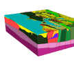
Sea-Floor Spreading and Subduction, How to Build a Model Illustrating — Three-dimensional, cut-and-paste paper model illustrating sea-floor spreading and subduction. | |||
| USGS | Modeling Geology Faults - SS, DS, Thrust, etc. Education resources Earth structure Plate tectonics | Lesson Plans | Middle School |
Visualizations of Geologic Hazards — Visualizing the Earth, its processes, and its evolution through time is a fundamental aspect of geoscience. The use of visualizations - diagrams, images, animations, maps, and more - is an essential tool in helping students to visualize the Earth and its processes. | |||
| Carleton College/NAGT materials | Lessons online Hazards Effects, Earthquake Education resources Tsunamis Modeling | Lesson PlansGraphics | High School General Audience College |
