The "Phelan Creek near Paxson" stream-gaging station, USGS station 15478040,
is part of the USGS network of nearly 100 stations in Alaska. Data collection and analysis
are conducted by standard techniques developed by the USGS. Daily values of discharge are
generally reported along with those for the rest of Alaska in annual publications of the
USGS Water-Data Report series, and available on-line (see links below).
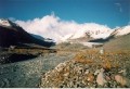
LOCATION: Lat 63°14'27"N., Long 145°28'03"W., 1,125 m altitude, in SW 1/4
sec.28, T.19 S., R.12 E., Hydrologic Unit 19020102, on left bank about 1 km downstream
from terminus of Gulkana Glacier and 23 km north of Paxson, Alaska.
DRAINAGE AREA: 32 km2 .
PERIOD OF RECORD: October 1966 to September 1978, October 1989 to September 1993,
October 1994 to current year, and annual maximums, water years 1984-85. Before October
1968, published as Gulkana Creek near Paxson.